DCS WORLD NEWSLETTER 12.08.2022
12 ago 2022 •
DCS World - Eagle Dynamics

DCS WORLD NEWSLETTER 12.08.2022
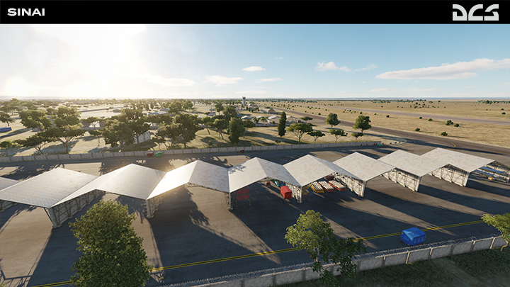
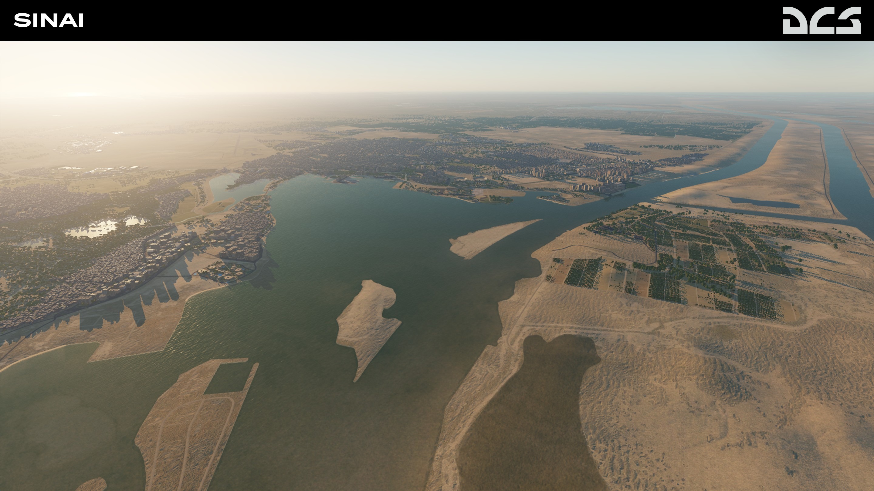
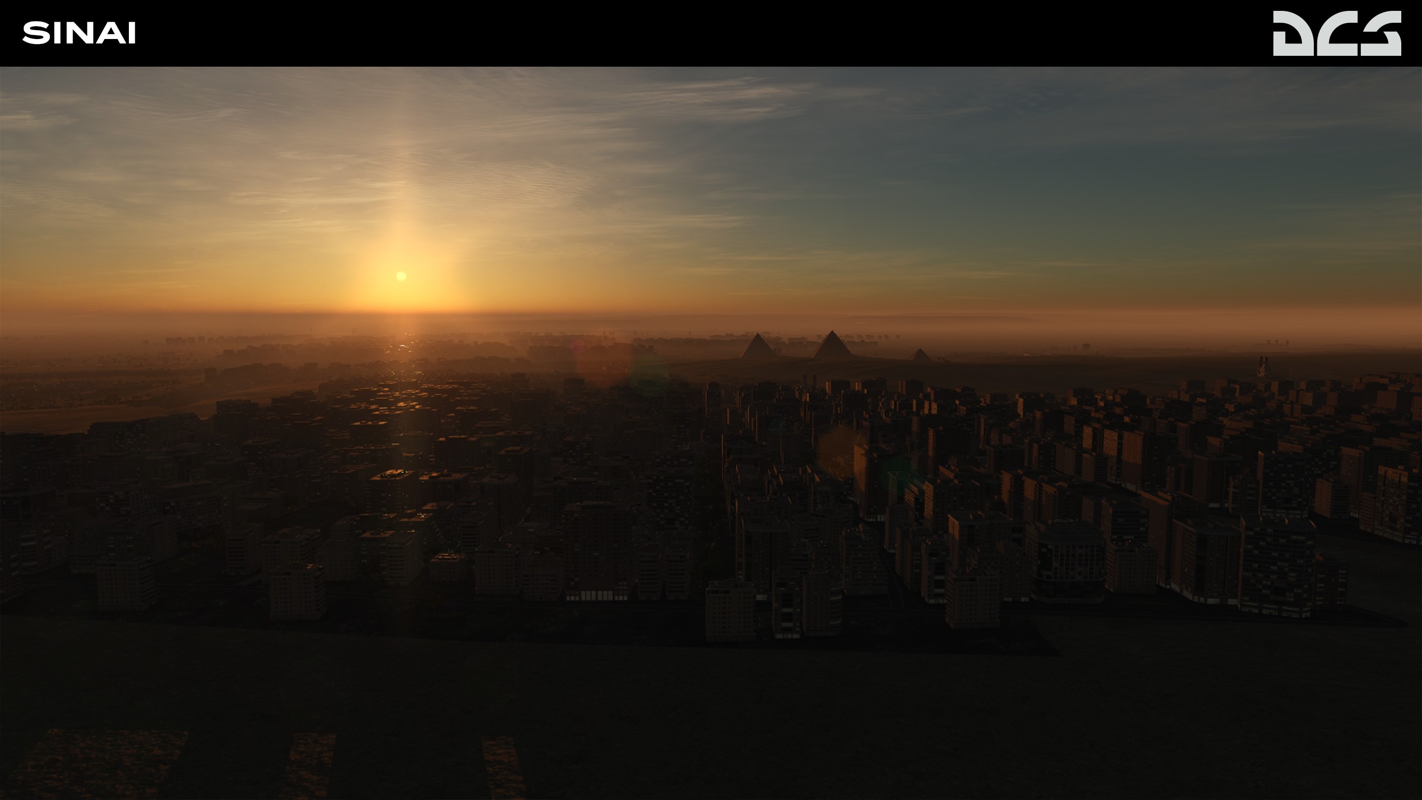
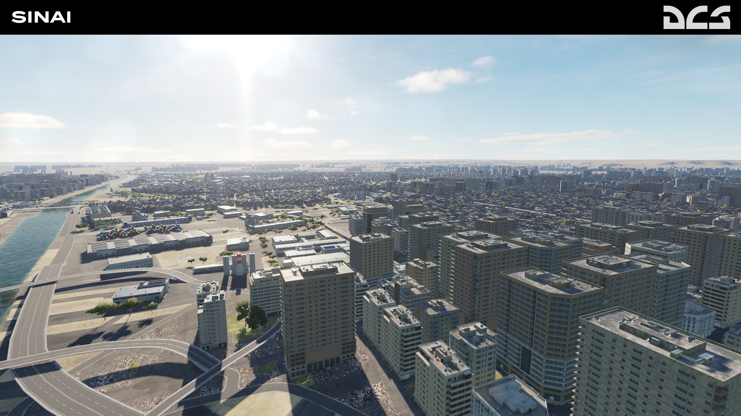
DCS: Sinai Development Report
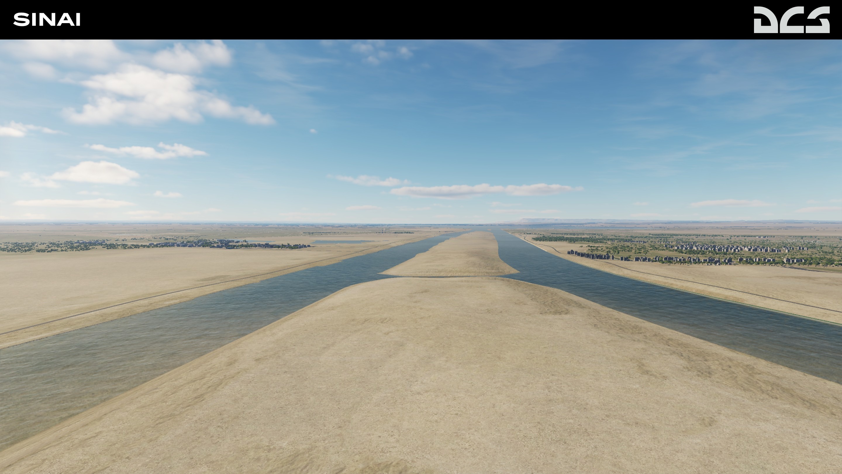
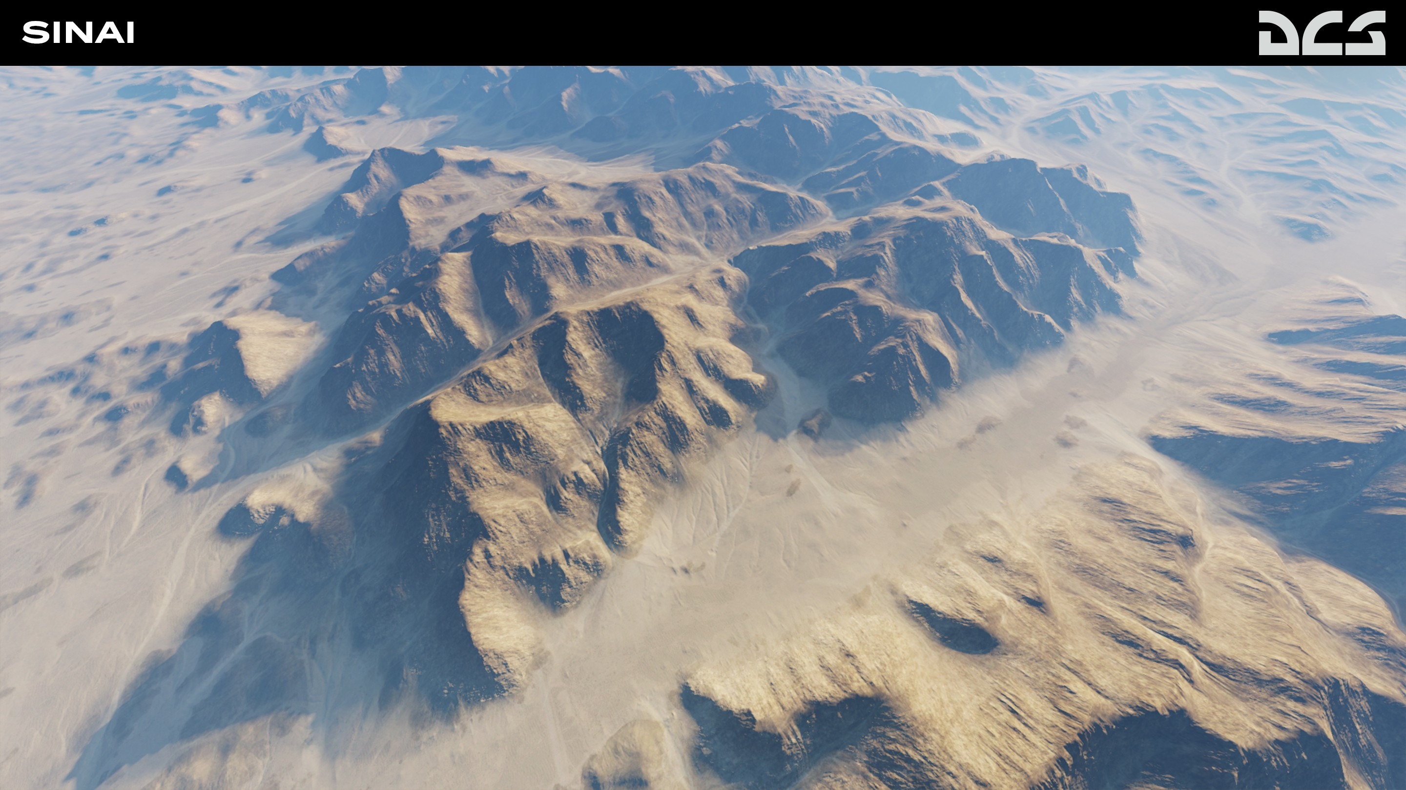
We are pleased to introduce the upcoming DCS: Sinai map by third party developer OnReTech. This stunningly accurate representation of the Sinai peninsula, eastern Egypt and southern Israel will provide many opportunities for missions and campaigns based on fictional and historical scenarios.
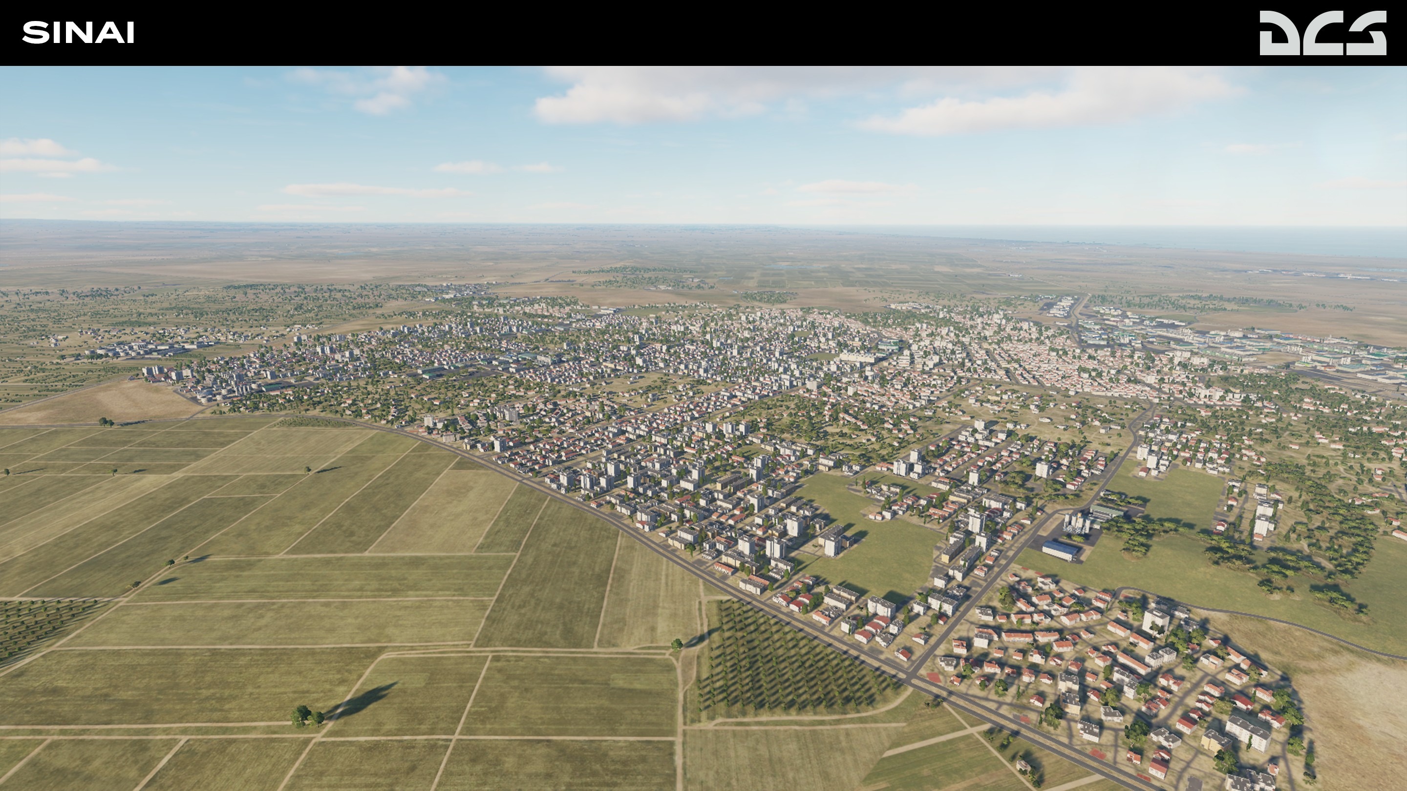
The total size of the DCS: Sinai map is 1500 x 1000 km, of which, 700x700 km will be in high-detail. The map includes the entire Sinai Peninsula, eastern Egypt and the Nile Delta, southern Israel including Gaza, western Jordan, and western Saudi Arabia. This area features a wide variety of landscapes like mountains, rivers, desert, agricultural areas, sea and bays that provide a variety of mission and campaign settings.
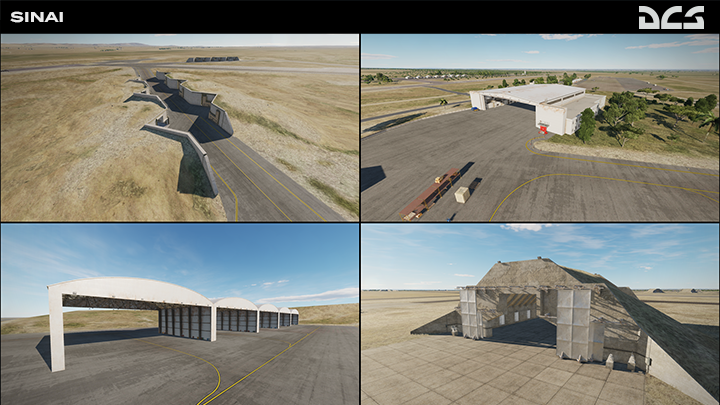
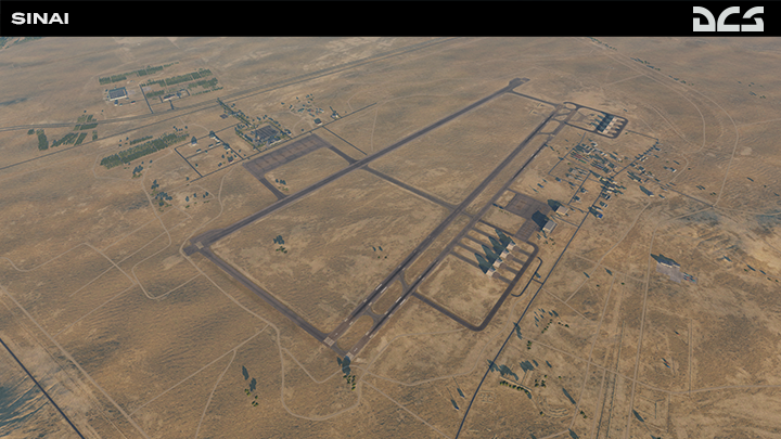
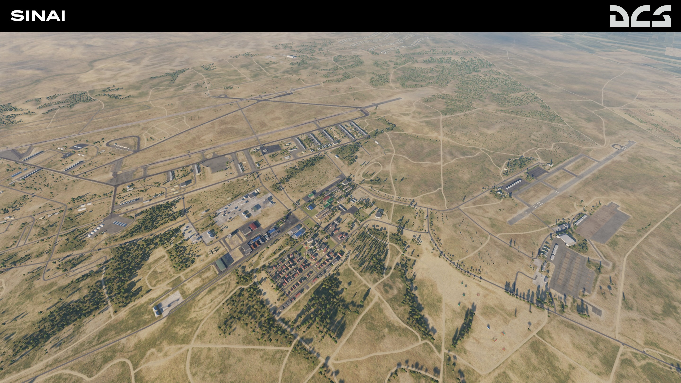
The map is being designed to represent the 2000s and up to the present. It is planned to recreate about 40 airfields, both military and civilian: Wadi al Jandali, Abu Suwayr, Faid Air Base, Nevatim Air Base, Ramon Airbase, and many more.
The map also contains many military bases and strategic seaports that allow for interesting strike missions. A large number of military facilities and bases will help realize various historical scenarios based on the Arab-Israeli wars, as well as fictional missions and campaigns.
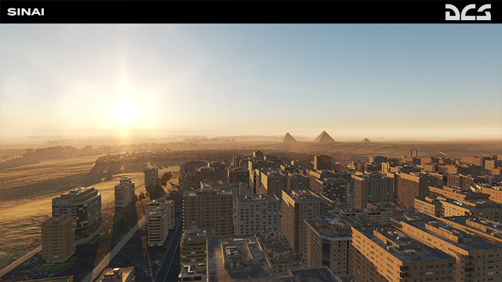
Major cities include Cairo (including Cairo International Airport), Ismailia, Alexandria, Suez, Port Said, and others. About 100 unique objects and architectural monuments will be included. All objects and assets are divided into territories to present greater unique, regional characteristics. The coastline of the Suez Canal, the Gulf of Suez, and the Gulf of Aqaba will be created in detail.
The project will consist of three phases, and each phase will include airfields, unique objects, and unique scenes. The first phase will include the entire territory with major cities and 14 air bases in Israel and Egypt. The second phase will add 11 more airfields. The third phase and final phase will add 12-14 more Egyptian military airfields. The OnReTech team is making every effort to ensure that customers will receive the first two phases in early access, which will help to fully reflect the theater of operations of the Arab-Israeli conflicts.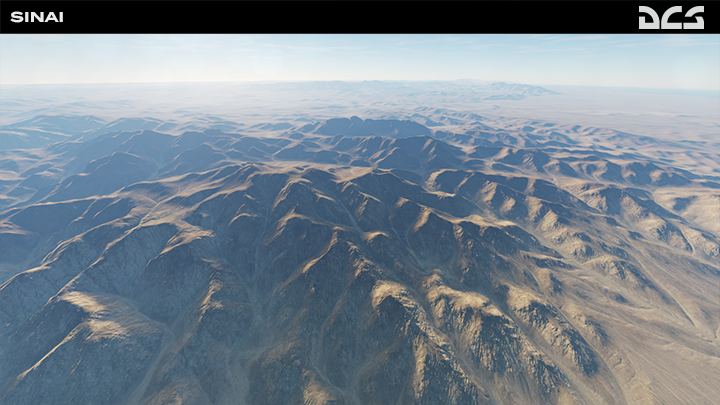
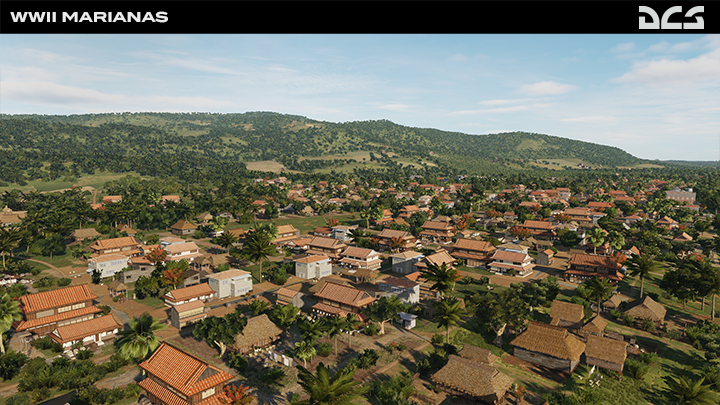
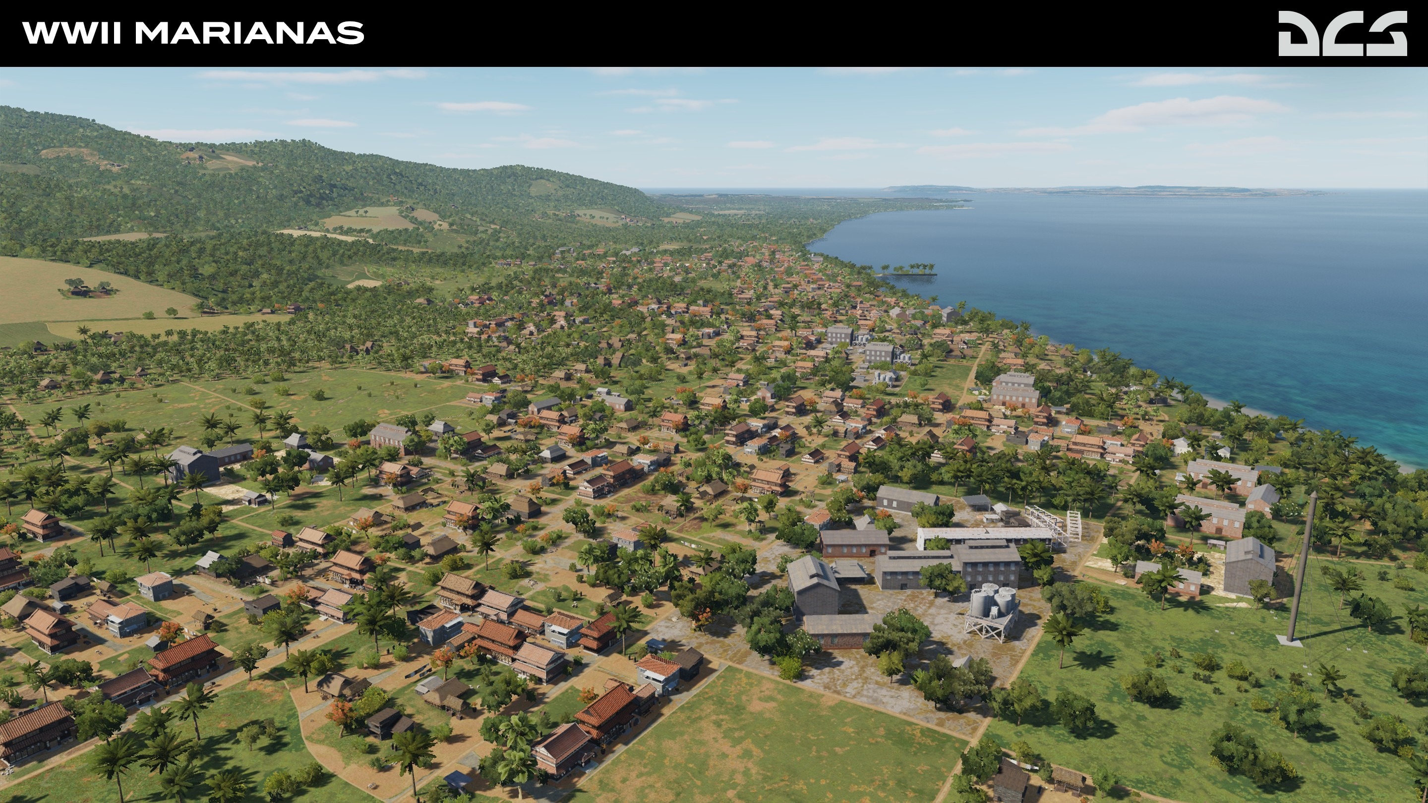
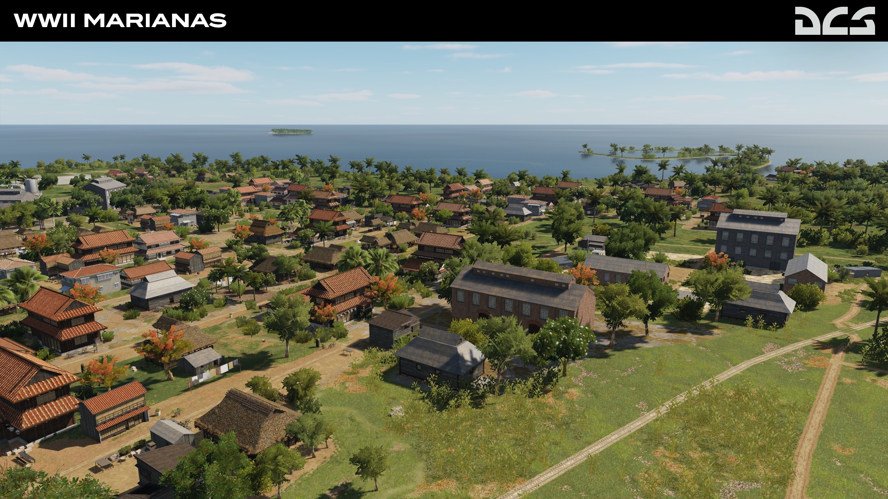
DCS: WWII Marianas Development Progress
In order to accurately depict the Mariana Islands in the summer of 1944, the coastline textures and fields are being completely redone based on actual pre-invasion maps courtesy of the United States Navy and Military. On the island of Saipan, all three Haruji Matsue plantations: As Lito, Chacha, and Marpi Point are being recreated. They provided tons of cane that was processed in the nearby sugar mills and taken to the Sugar Dock to be shipped to Japan.
The entire island of Tinian is also being recreated in high detail, and it comprises the original Japanese airfields. This large and mostly flat area is also where the first napalm bombs were used against Japanese soldiers hiding in the surrounding jungle and outlying small islands. We are also making improvements to the coastline, settlements, and palm plantations. For more, please check out the Development Screenshots.
Shortly before the retaking of Guam by US forces in June 1944, the island was still under control of the Japanese, it consisted of very small villages occupied by the native Chamorro people. In the modern Marianas map, a lot of this area is covered by cities, but in the Second World War, the land was made up mostly of palm plantations.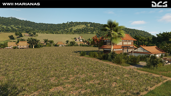

FONTE https://forum.dcs.world/topic/304804-official-news-2022/?do=findComment&comment=5027374
Simulatori
- Falcon BMS
- East Mediterranean Front Theater
- IL-2 Sturmovik
- DCS World - Eagle Dynamics
- DCS: F-16C Viper
- DCS: Ka-50 Black Shark
- DCS: A-10C Warthog
- DCS: P-51D Mustang
- DCS: MIG-21BIS
- DCS: F/A-18C Hornet
- DCS: Combined Arms
- Microsoft Flight Simulator
- Altri simulatori
Reparti AMVI
- SMAV
- Comando Squadra Aerea
- Comando Scuole
- Reparto Affari Generali
- Reparto Sperimentale Volo Virtuale
- Gruppo Falcon
- Gruppo Hornet
- Gruppo IL2
- Gruppo Black Shark
- Gruppo Warthog
- Gruppo Radar
- Accademia
- RACSAV
- Vola con AMVI