Area dedicata ai simulatori di volo
-
Phant
- Capitano

- Messaggi: 14316
- Iscritto il: 19 settembre 2003, 15:14
- Località: Olbia
-
Contatta:
Messaggio
da Phant » 11 marzo 2022, 18:11
Graphics - Staff ha scritto:
 WWII Marianas Development Progress
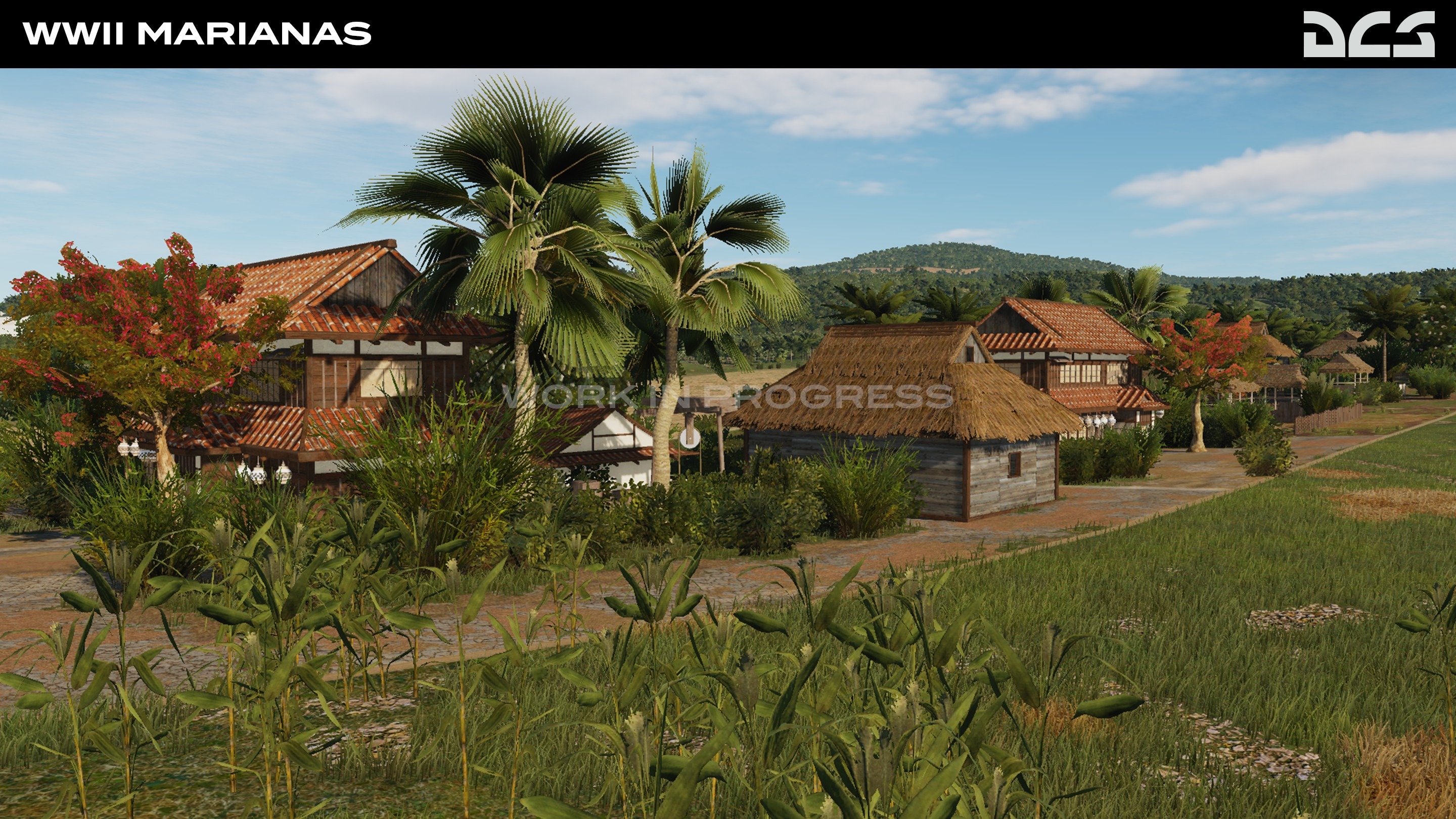
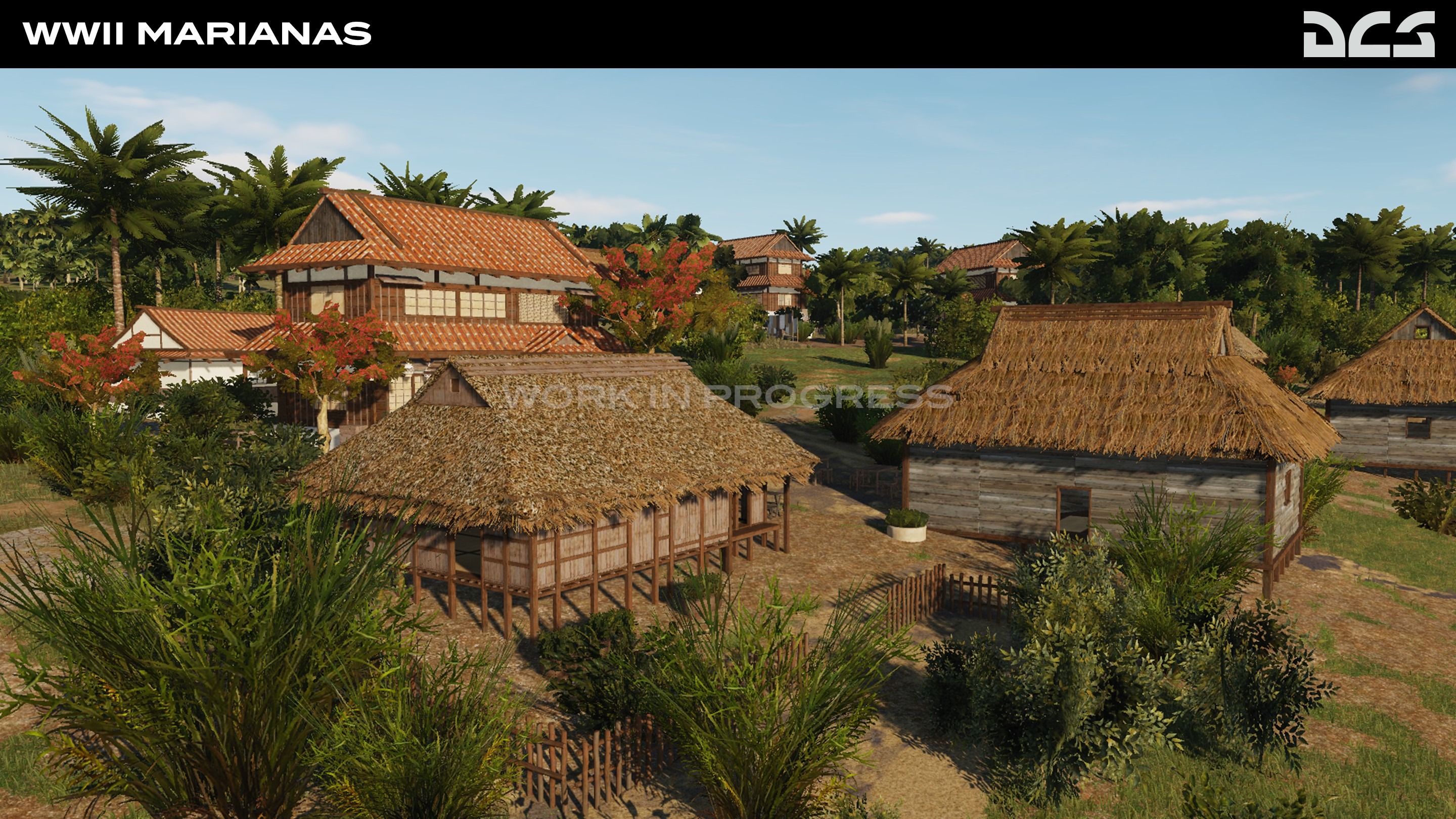
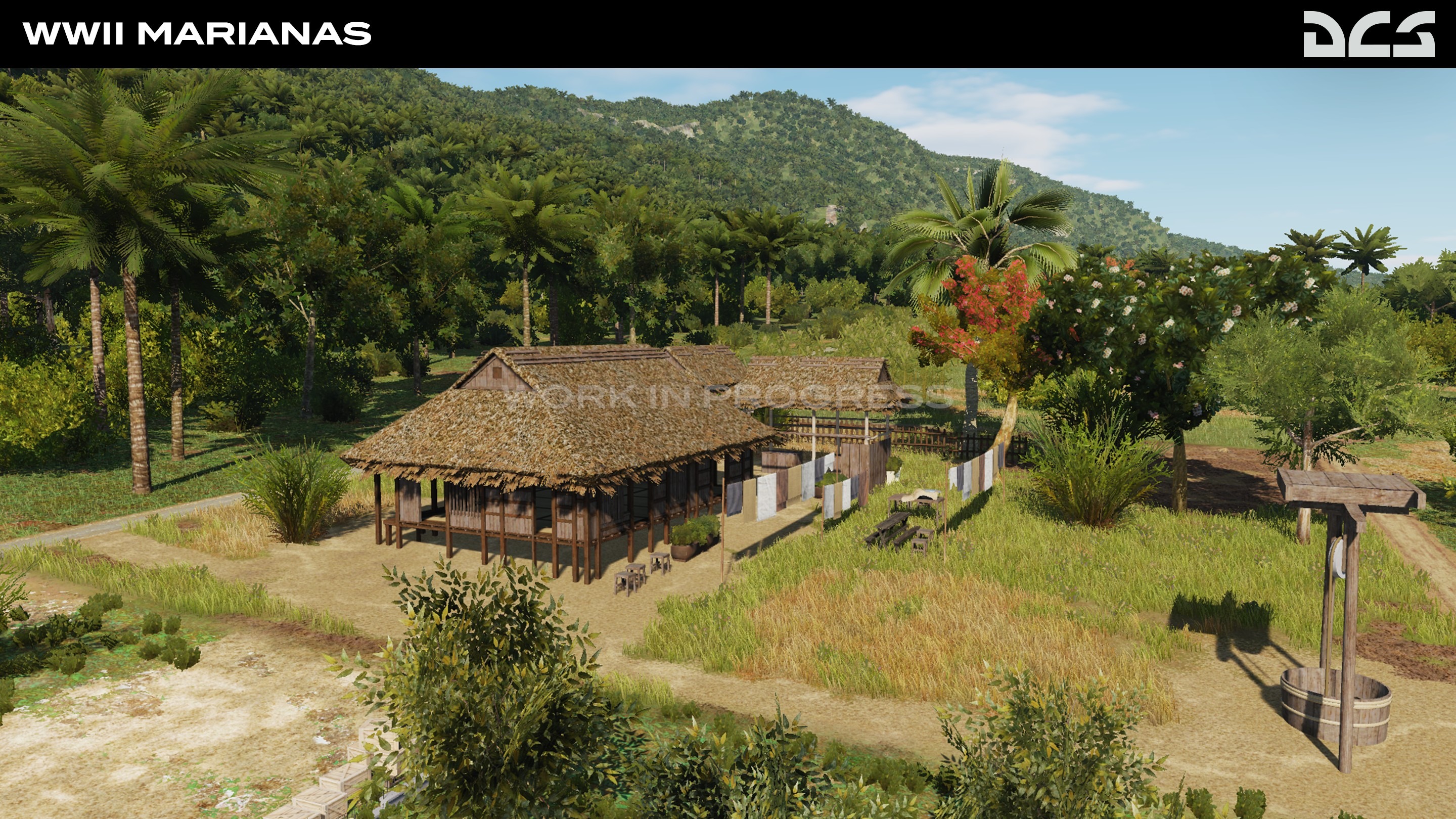
Except for the presence of a naval administration on the island, pre-war Guam was basically a land of farmers and fishermen living a simple and peaceful life. The US territory of Guam and the Northern Islands, which are part of the Japanese World War I mandate, will be included in the initial Early Access release.
A number of Japanese settlements and local Chamorros regions, as well as agricultural pastures, predominantly sugar cane fields, are visible in the Development Screenshots.
The task of creating this map to match the visual quality and accuracy of the modern Marianas map includes new texturing to most of the land masses and creating countless new objects. It is a large task that is making steady progress and we look towards your comments.
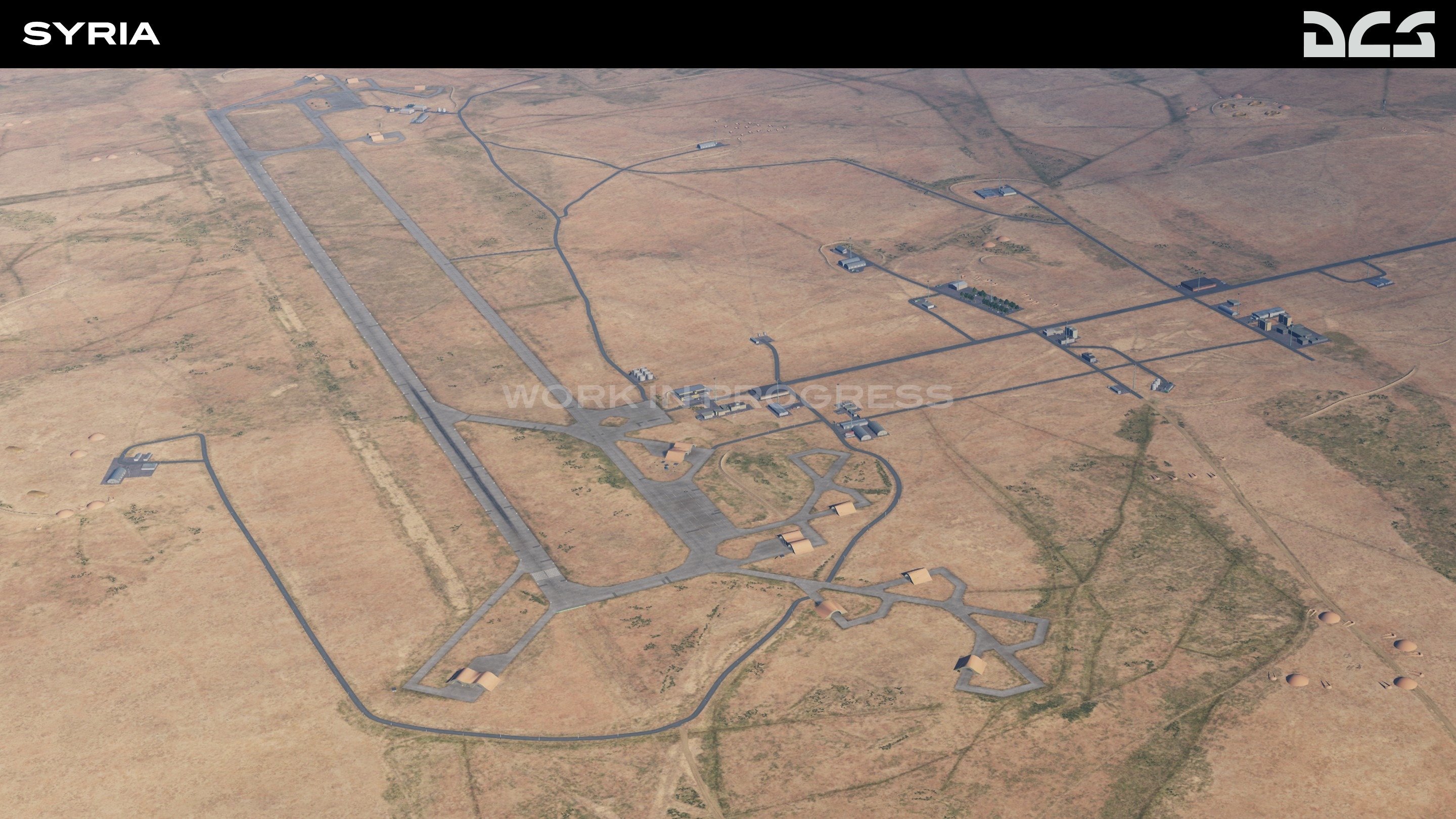
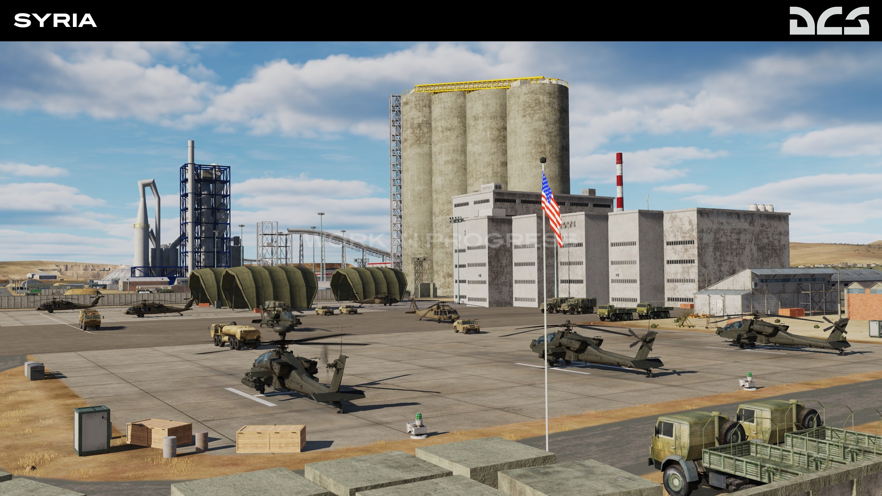
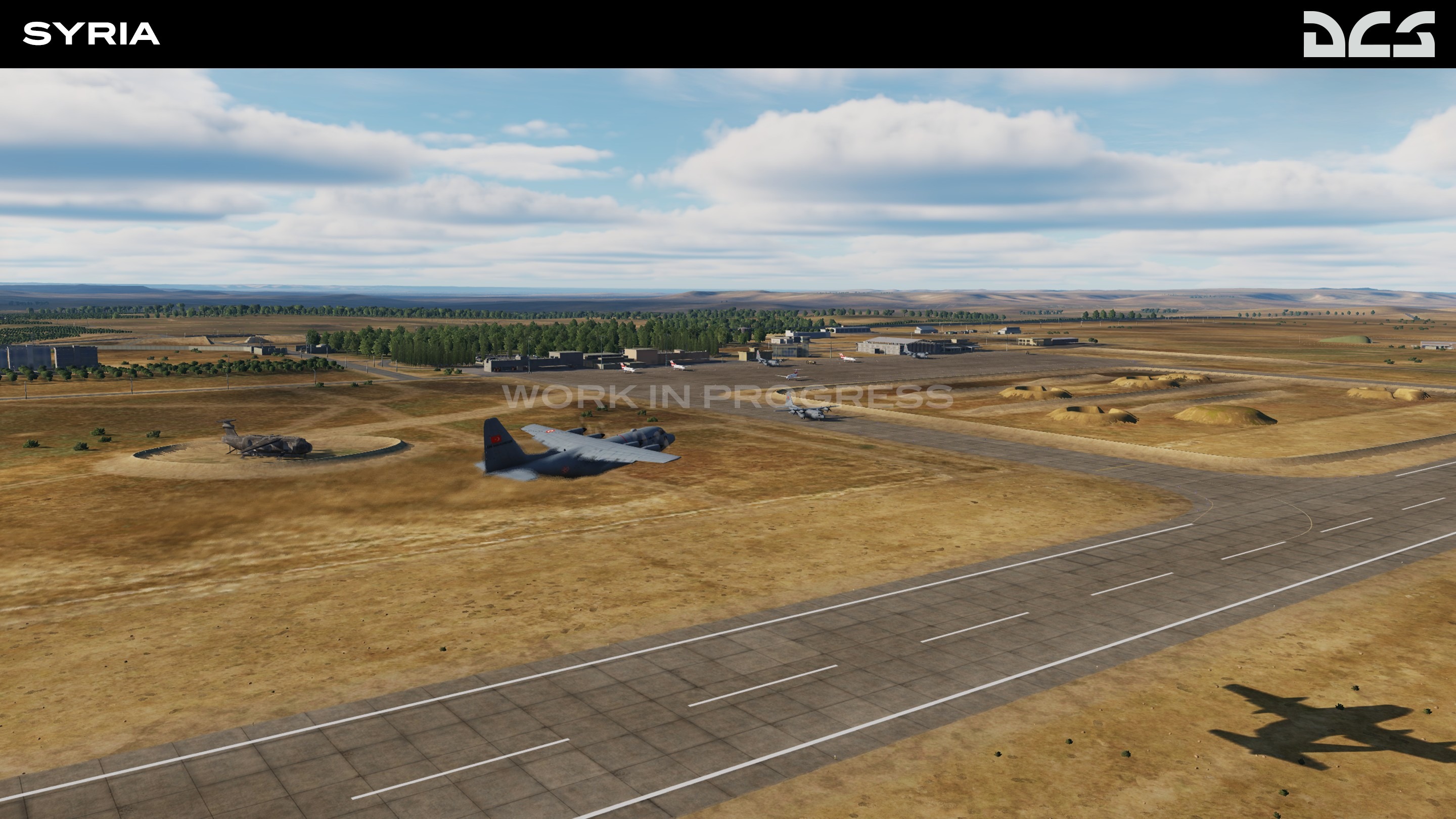
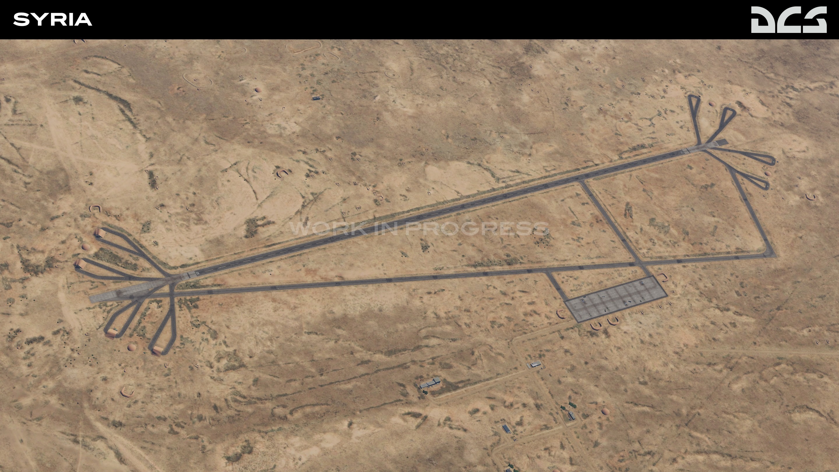
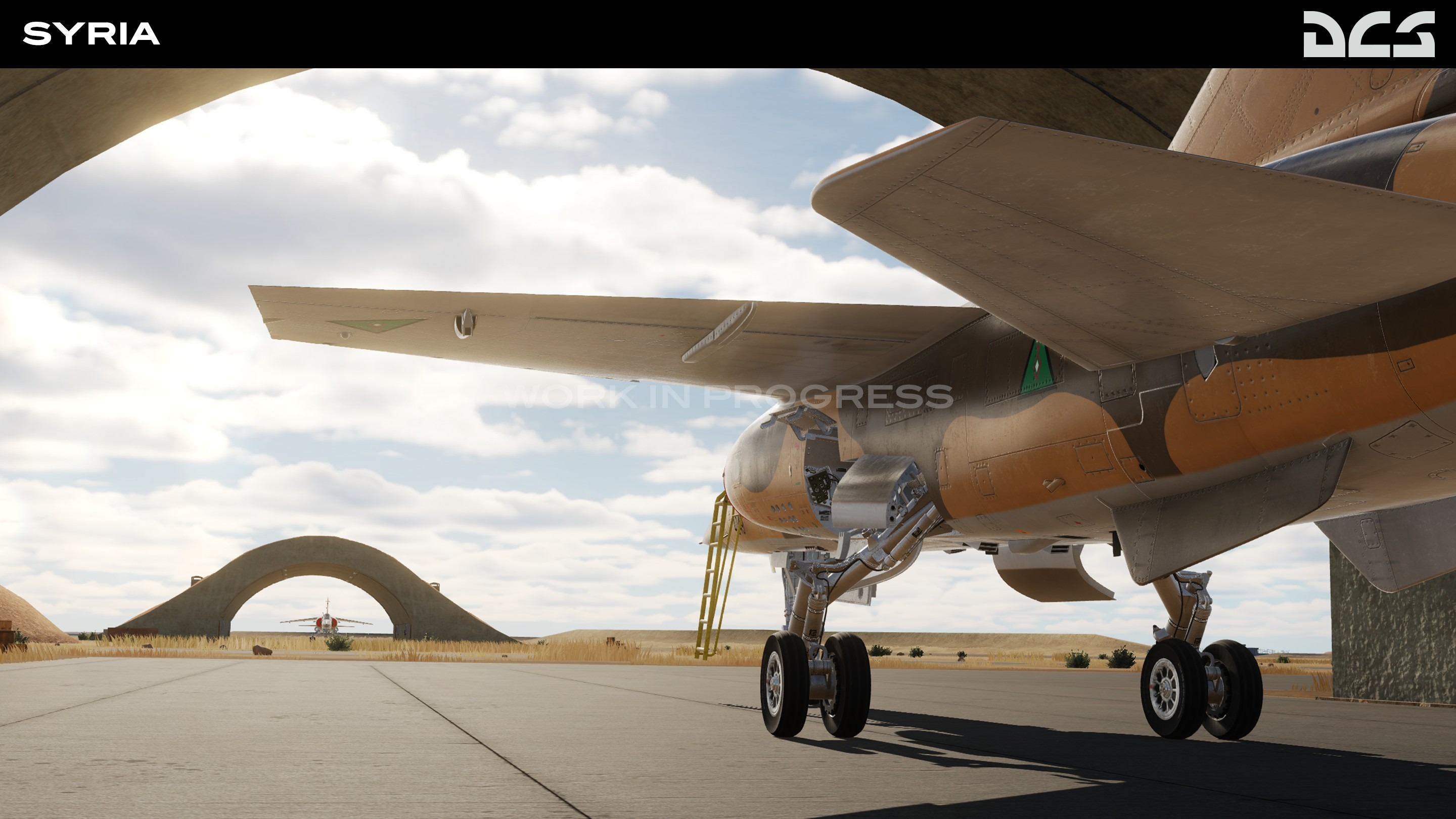
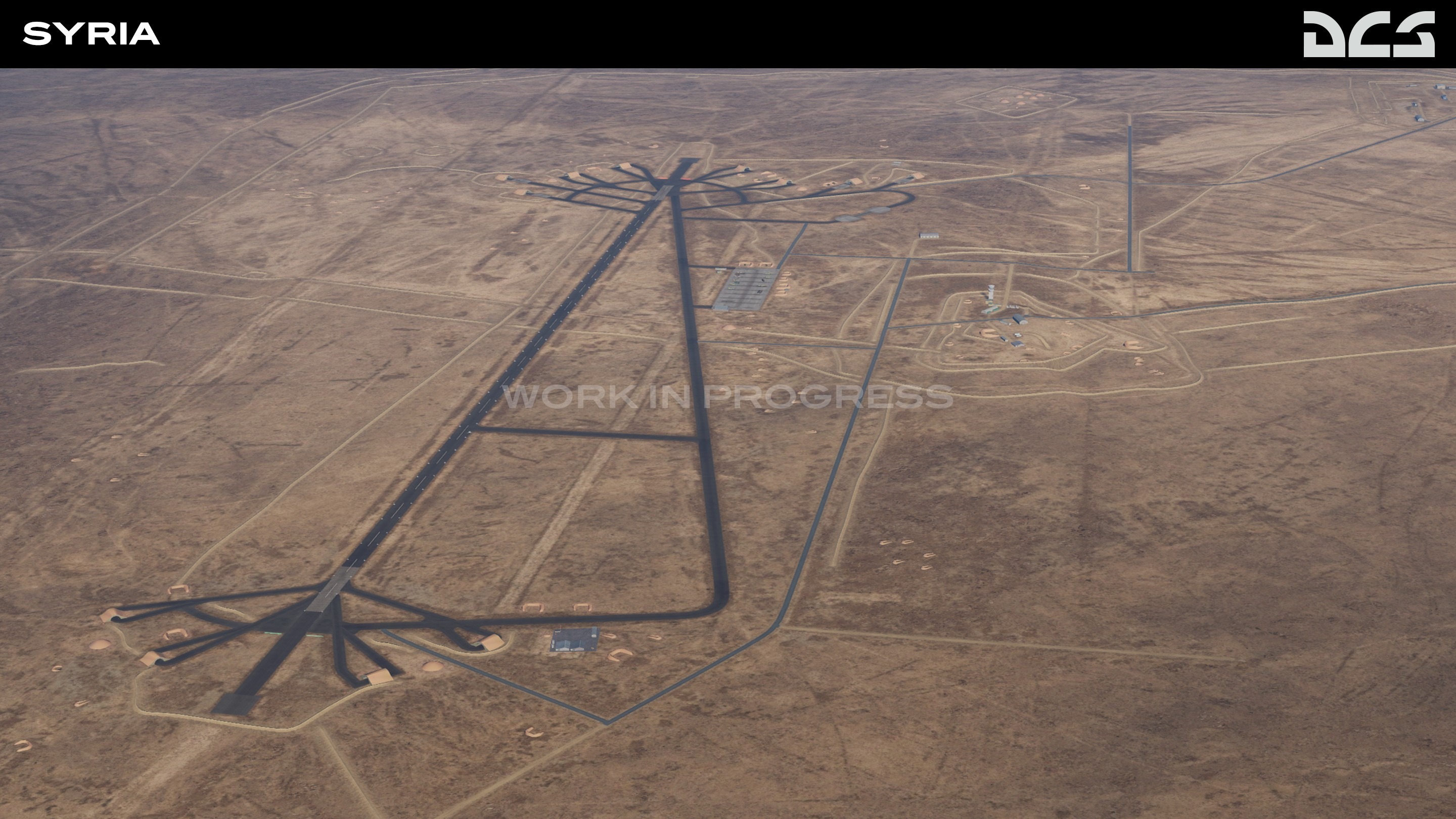
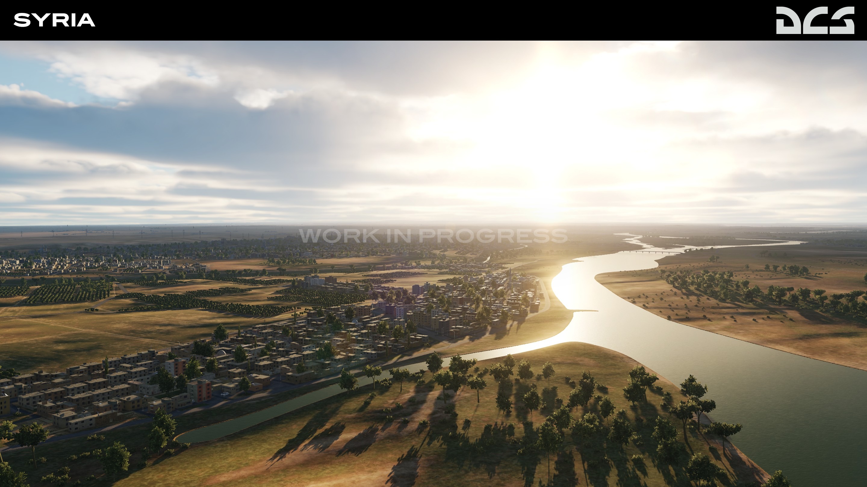
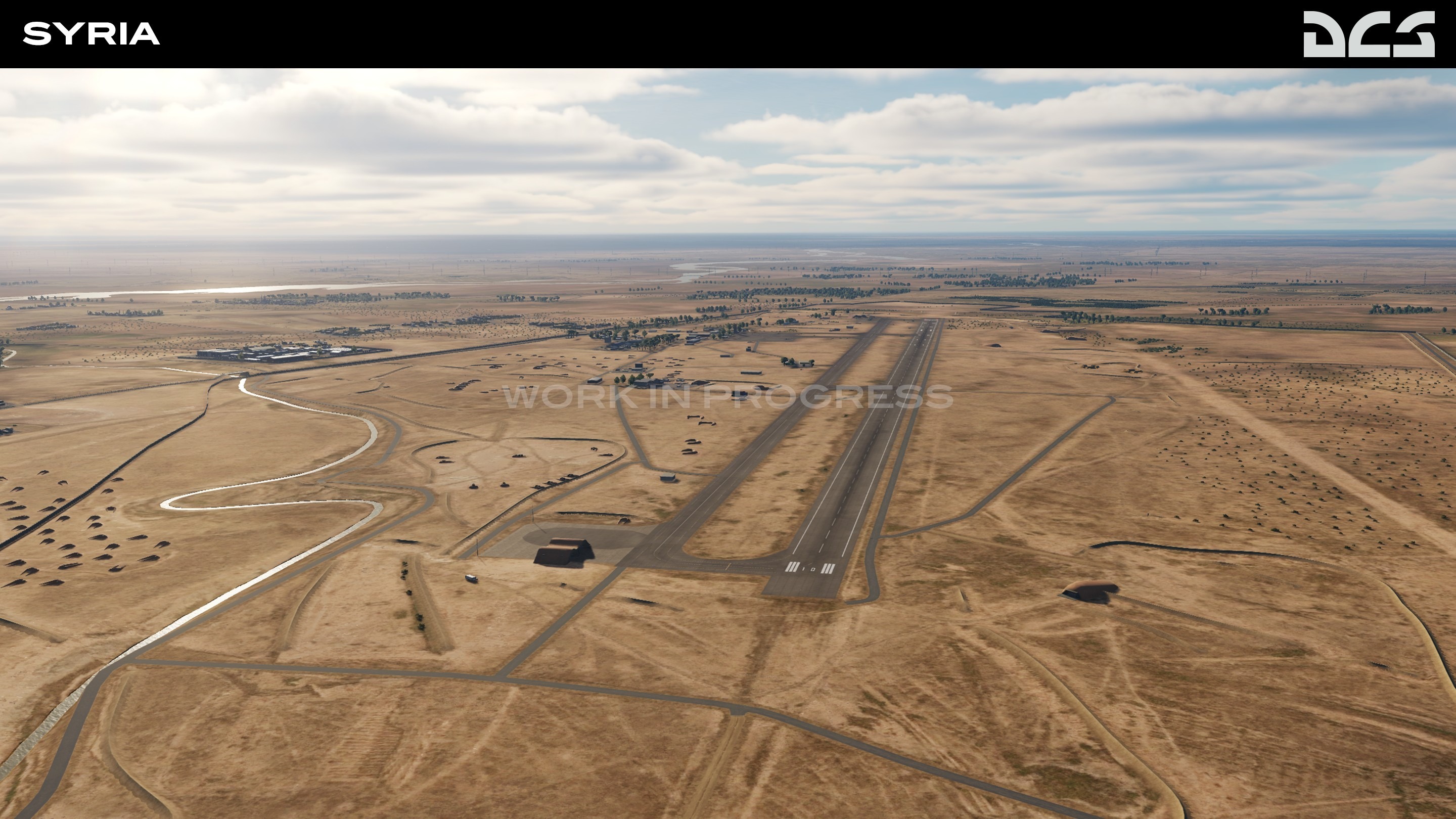
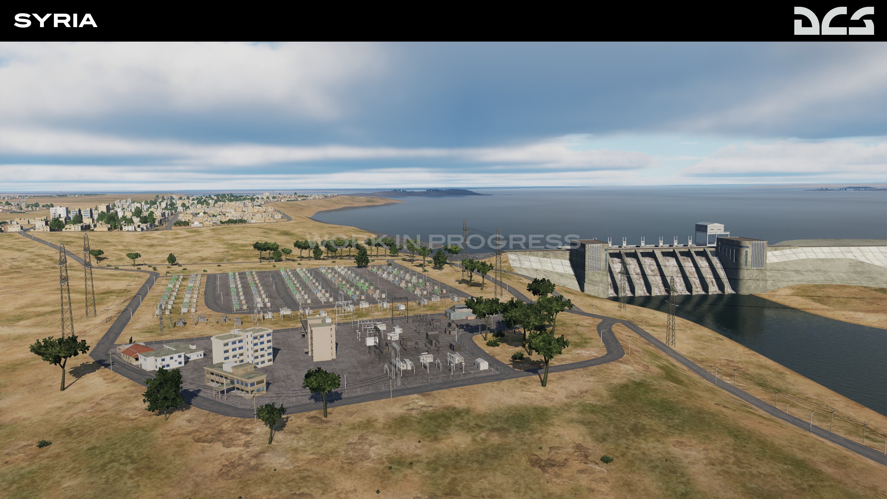
Syria Development Report
In the coming Open Beta update, the DCS: Syria map size will increase eastward by 250 km to Deir ez-Zor airbase in Syria. A large section of the Euphrates River Valley in the eastern part of the map will be included, as well as parts of western Iraq to include H3, H3 Northwest, H3 Southwest and Ruwayshid airbases. You can also look forward to the Ataturk Dam and Şanlıurfa International Airport in Turkey.
Also be on the lookout for the abandoned dirt airfield east of Sayqal AirBase and Tal Siman military base located to the north of the city of Raqqa. The Kharab Ishk helicopter base, located on the territory of the Lafarge factory, At-Tanf military base on Syrian-Iraqi border, and the oil facilities in Deir ez-Zor area are also included.
The focus on the map update is to better support historic AH-64D missions during the war on ISIS.
This will be a free update to DCS: Syria
Bye
Phant

-
Phant
- Capitano
- Messaggi: 14316
- Iscritto il: 19 settembre 2003, 15:14
- Località: Olbia
-
Contatta:
Messaggio
da Phant » 5 aprile 2022, 1:10
-
Phant
- Capitano
- Messaggi: 14316
- Iscritto il: 19 settembre 2003, 15:14
- Località: Olbia
-
Contatta:
Messaggio
da Phant » 23 maggio 2022, 23:56
-
Phant
- Capitano
- Messaggi: 14316
- Iscritto il: 19 settembre 2003, 15:14
- Località: Olbia
-
Contatta:
Messaggio
da Phant » 8 giugno 2022, 13:03
-
Phant
- Capitano
- Messaggi: 14316
- Iscritto il: 19 settembre 2003, 15:14
- Località: Olbia
-
Contatta:
Messaggio
da Phant » 9 giugno 2022, 0:24
Digitalcombatsimulator.com ha scritto:
DCS: South Atlantic Map by RAZBAM
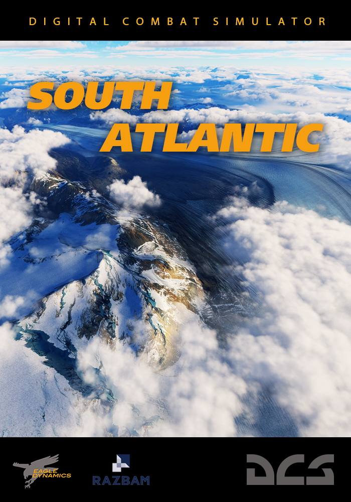
The RAZBAM Terrain Development Team proudly presents the South Atlantic map. It is a beautiful, majestic combination of Argentina, Chile, and the Falkland Islands based on the present day. The topography includes the beautiful and rugged Andes mountains of Chile, the vast and colorful Patagonian plains of Argentina, and the windswept islands of both West and East Falklands/Malvinas islands. Covering an area of 3.1 million square kilometers, the goal has been to give DCS content creators and customers the opportunity to develop missions that reflect the scale and complexity of modern-day operations in the South Atlantic.
The South Atlantic Map was developed whilst proactively listening to DCS customers' wishes regarding the scale and requirements of a modern-day theatre of operations. This has resulted in a map that is comprised of land-class textures drawn from aerial and satellite photography.
During the Early Access period, the South Atlantic Map will be further improved with:
- Refined noise map tiles.
- Improved detail to sea cliffs.
- Elimination of forest tile lines.
As a bonus we will be including a generous asset pack in the near future. Coming very soon with the map are the following assets, but not limited to:
Naval:
- Castle class patrol vessel
- Harbour tug
- HMS Invincible aircraft carrier
- HMS Achilles frigate
- HHS Andromeda frigate
- HMS Ariadne frigate
- Almirante Lynch frigate
- Almirante Condell frigate
- Santa Fe frigate
- ARA Veinticincol.de Maya (currently being worked on and will be included during EA)
Vehicles:
Placeable:
- Tower crane
- Small lighthouse
- Wind turbine (Offshore and Land based)
- KAT345L Excavator
- The Assets pack will be expanded as and when each unit has been completed.
Free disk space is required: 66 Gb
Bye
Phant
-
Phant
- Capitano
- Messaggi: 14316
- Iscritto il: 19 settembre 2003, 15:14
- Località: Olbia
-
Contatta:
Messaggio
da Phant » 9 giugno 2022, 0:28
myHelljumper ha scritto:
RAZBAM South Atlantic Map early access release note
Hello fellow rotary and fixed wing aircraft enthusiasts. With the imminent early access release of the South Atlantic map, we, the team, wanted to give everyone a heads-up about what you can expect from the initial early access release so you can make an informed purchase.
We believe it’s important to be open and transparent regarding the current state of the project in early access and to share our goals moving towards full release and beyond.
Scope of the map
Since it would be our very first terrain module, the initial scope of the map was to represent the Falklands/Malvinas islands at the time of the Falklands conflict to have an interesting but small scale map for the team to work on. We soon realized it would be very restrictive for current aircraft in DCS to limit the map to what was available in 1982. For example the 80’s era runway at Mount Pleasant is too short to land an F16 on but we do hope to add era-specific options for the map in future for those who wish to create historically accurate scenarios.
After listening to the community, the team decided to also include part of the South American content, to greatly increase the possibilities offered by the map. This scale change increased our workload by a factor of 75, which resulted in the map releasing in 2022 instead of 2020. We hope that you will agree that this decision was for the best.
Including part of the South American continent really pushes the bounds of DCS maps in terms of size as this map will be the biggest yet with 3.1 Million km² total size.
Technology
In order to make this map as realistic as possible we decided at the early stages of the project to use satellite imagery as a base for the ground textures, providing the user with the most realistic depiction of that part of the world that we possibly could. This has provided the unique challenge of having to hand “clean” every part of the landmass to remove clouds, buildings, seasonal stitching and discoloration. This single task has taken thousands of man hours to accomplish and we’re still working on it through early access.
For all Airfields and cities we have used the highest custom texture technology available within DCS currently, which is known as splatmap technology and makes use of high quality custom designed textures.
In order for the map to look good at low altitude, the team needs to work on improving the mesh and textures by hand as well as adding objects like rocks, debris, additional trees and bushes. This work is very time consuming which, combined with the size of the map means we do ask for a little patience while we work on this throughout early access.
Current state of the map
Over the past few months we have concentrated mostly on the Falklands/Malvinas islands by, for example, refining the technology for cliff generation. We still have more work to do on the mainland, while the major cities are pretty much done with regards to placement like Rio Gallegos, Rio Grande, Ushuaia and a few others, there is still more work to be done. As you can imagine the map is absolutely massive.
At this stage of the project the team feel that the map is good enough to be enjoyed by the public under EA. However, due to the fact that the mainland low altitude level of detail is still not up to the high standard we aim, more work will be done to it in a steady and timely manner during EA.
The current size of the map is around 70 GB, if we had taken the decision to render all land masses using the highest quality textures, the map would have been around 250 GB. So there is a happy balance to be had with size compared to texture quality for the areas between the populated airfields, towns and cities.
The team will be moving their focus from the Falkland/Malvinas Islands over to the mainland to address the issues and enhance the areas mentioned above.
Assets pack
Due to the requirement for further testing, we are not able to ship the assets pack with the map at this current time. The full assets pack which includes the ships will be pushed by ED at the next update.
Our original thought was to delay the initial release of the map so that the assets could be included, however we feel that these are not the main focus of the map but are an enhancement. In addition to this we have decided to allow the first wave of the assets to be included into the core game, so this means everyone will get them for free whether they purchase the map or not.
Conclusion
We hope this early access release note has given everyone in the community enough information to make a well informed purchase and has explained the scope of our project.
We are really proud of the work that has been done so far, everyone on the team has worked incredibly hard on this and we are committed to go as far as possible with the current software and hardware limitations to bring you the best depiction we can of this beautiful part of the world to enjoy in DCS.
Bye
Phant
-
Phant
- Capitano
- Messaggi: 14316
- Iscritto il: 19 settembre 2003, 15:14
- Località: Olbia
-
Contatta:
Messaggio
da Phant » 15 giugno 2022, 20:39
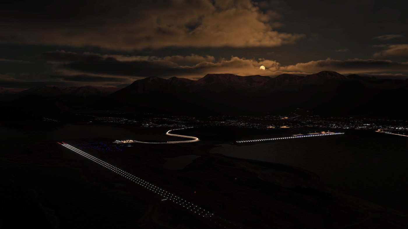
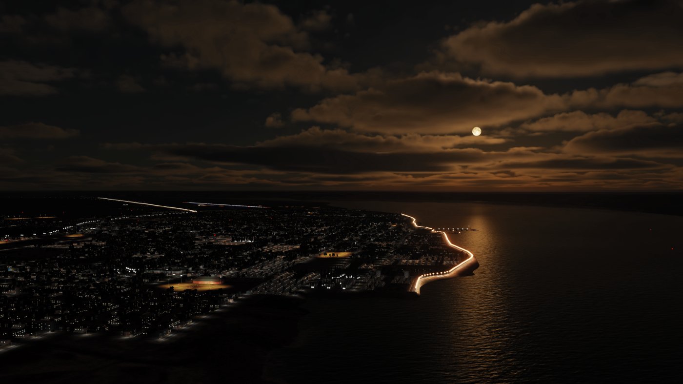
RAZBAM_Specter ha scritto:
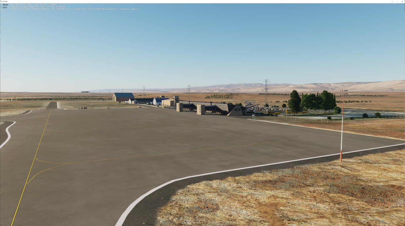
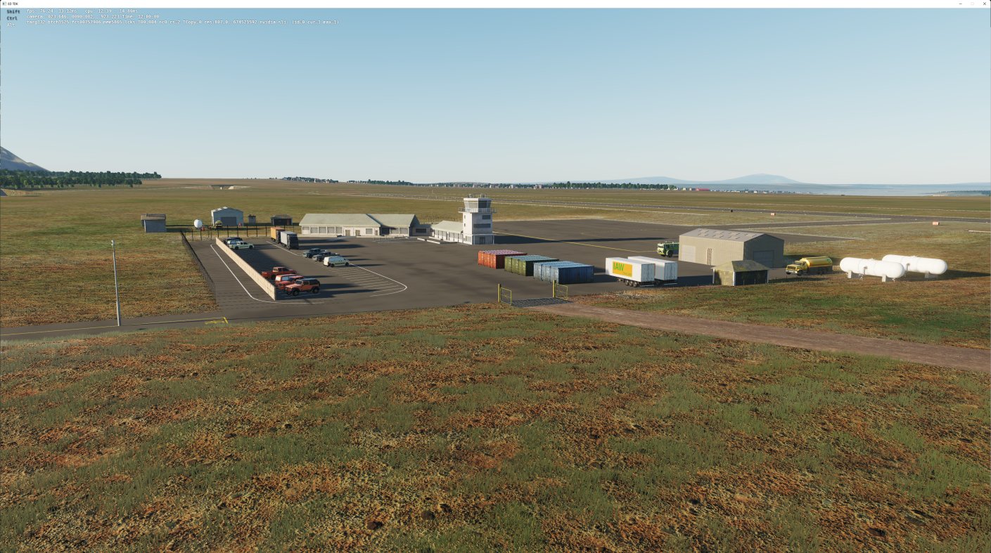
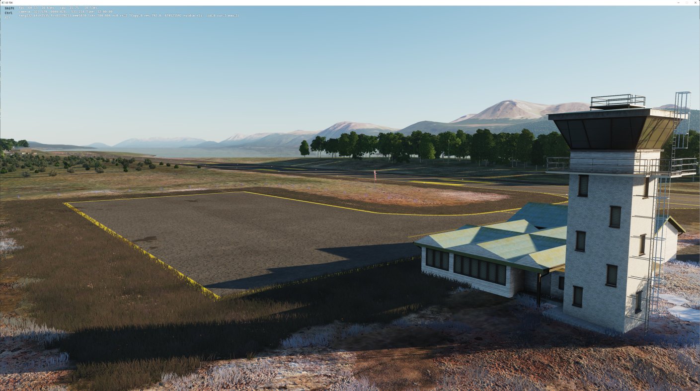
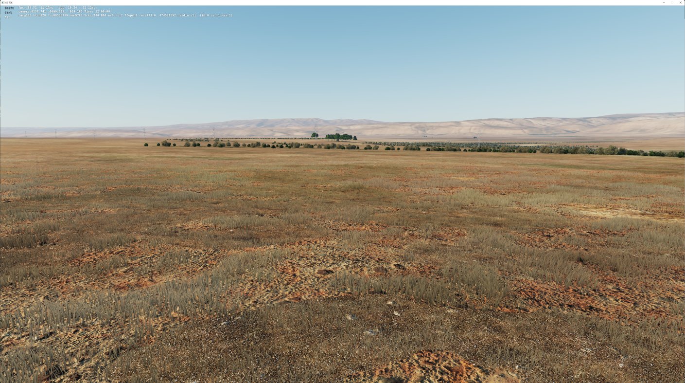
Just a quick couple of screenshots of what we have completed this week. New airfield Added Pampa Guanaco, still one building to add then the airfield is completed, oddly this building that we are now adding burned down last week in real life (promise it wasn't us  ) We are continuing to add the grass low level detail to the mainland which does make a massive difference when at low level. I also just wanted to say for those that bought the map a big thank you from the Terrain Development Team, your faith and support is really appreciated.

 FONTE https://discord.com/channels/5363891252 ... 3800450078
Bye
Phant
-
Phant
- Capitano
- Messaggi: 14316
- Iscritto il: 19 settembre 2003, 15:14
- Località: Olbia
-
Contatta:
Messaggio
da Phant » 29 luglio 2022, 17:59
Graphics - ED Team ha scritto:
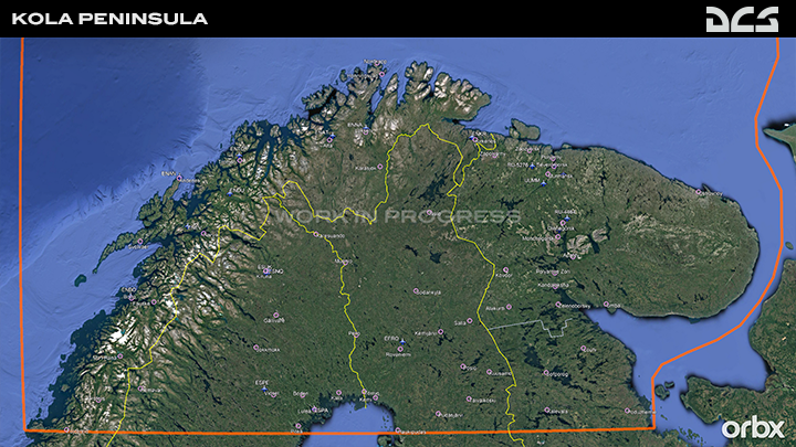
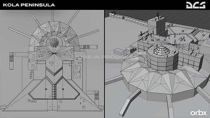
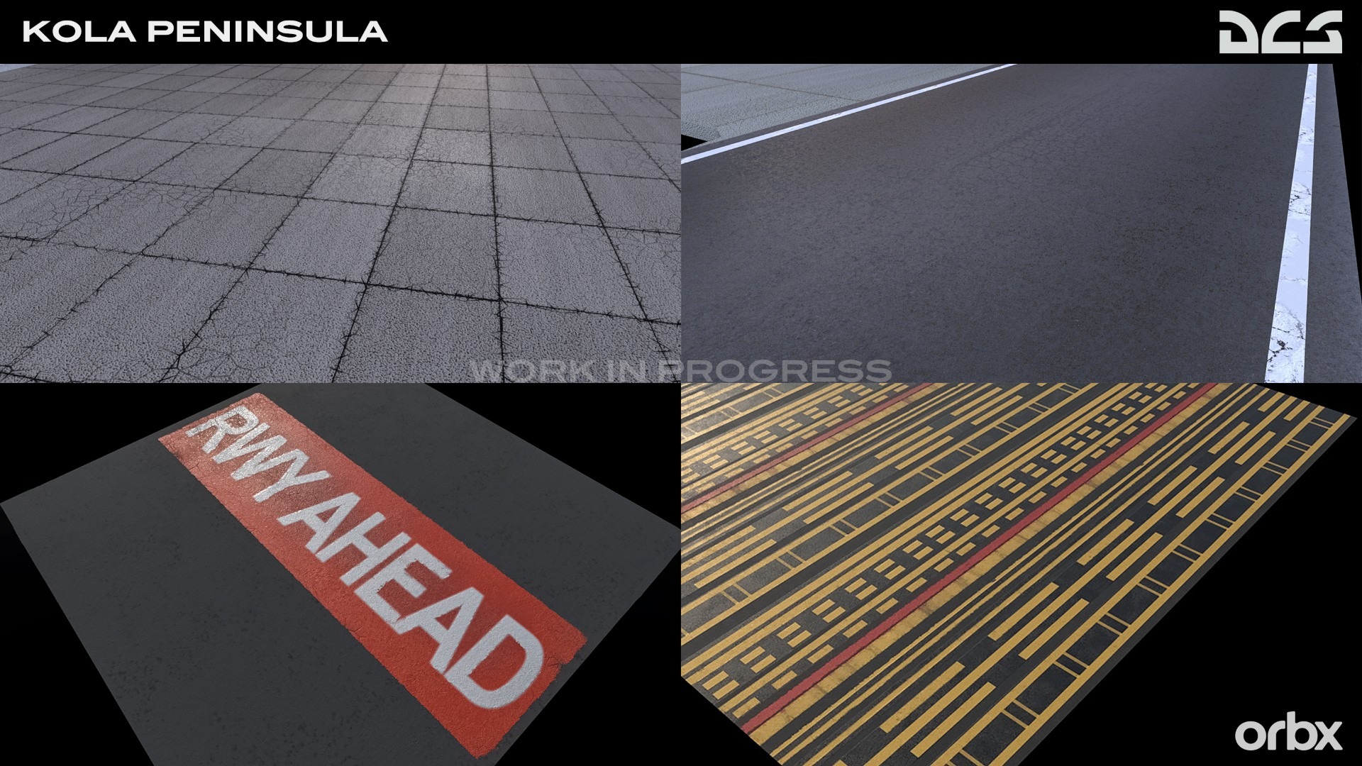
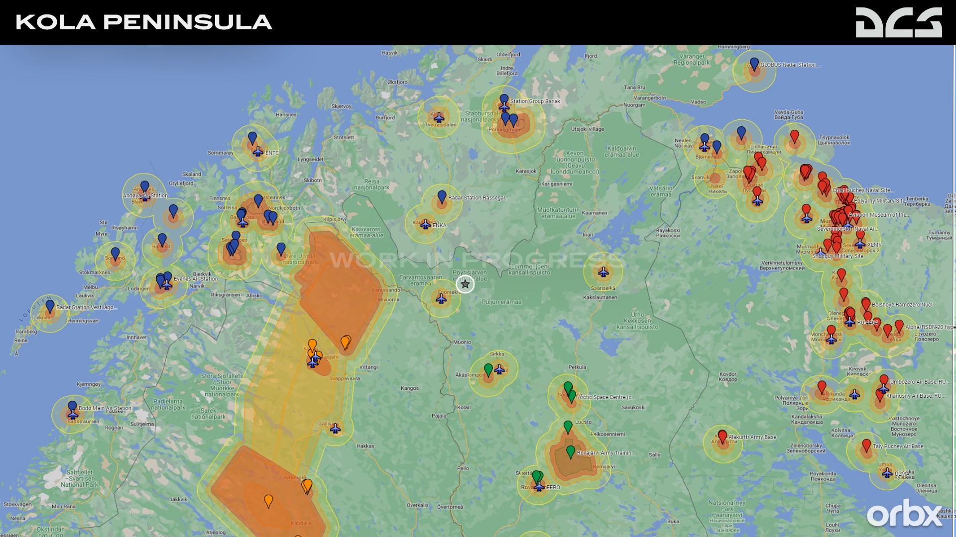
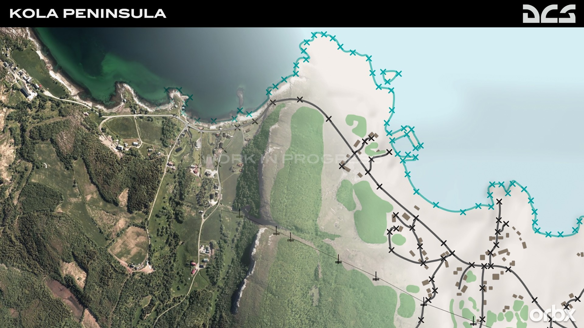
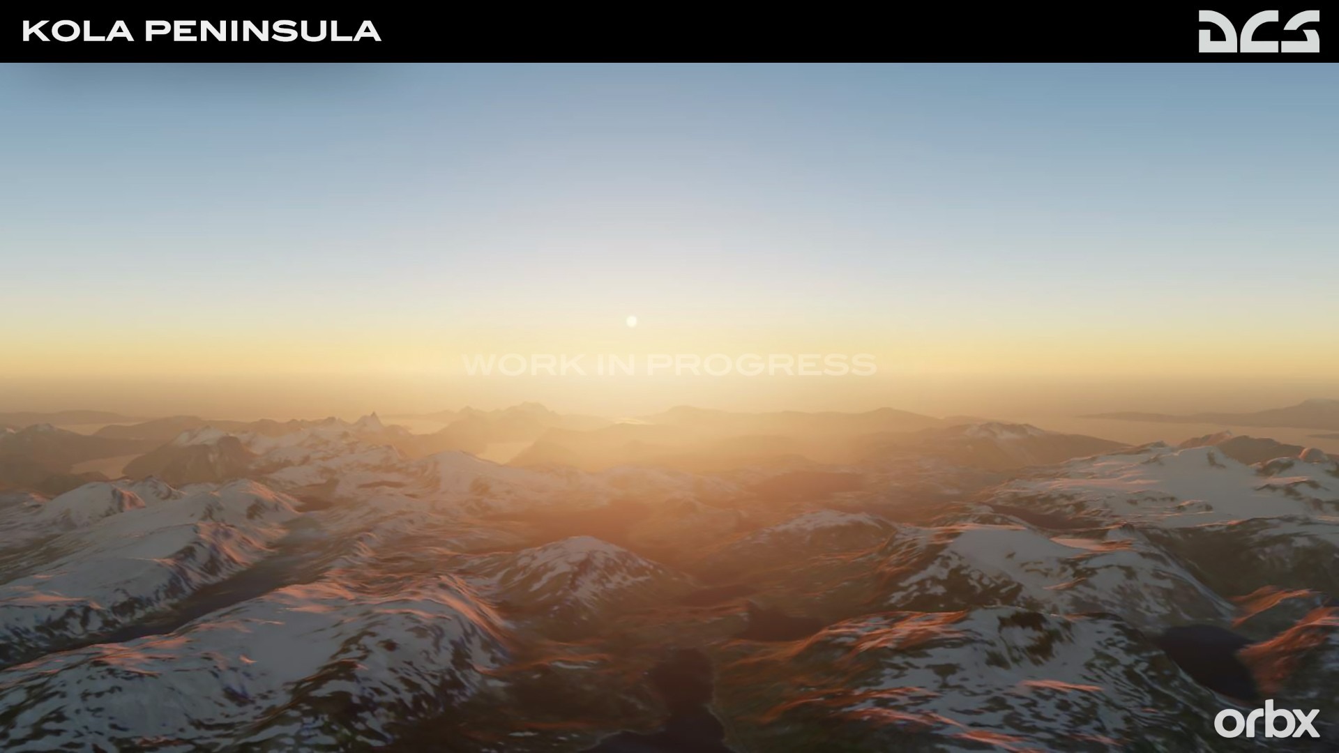
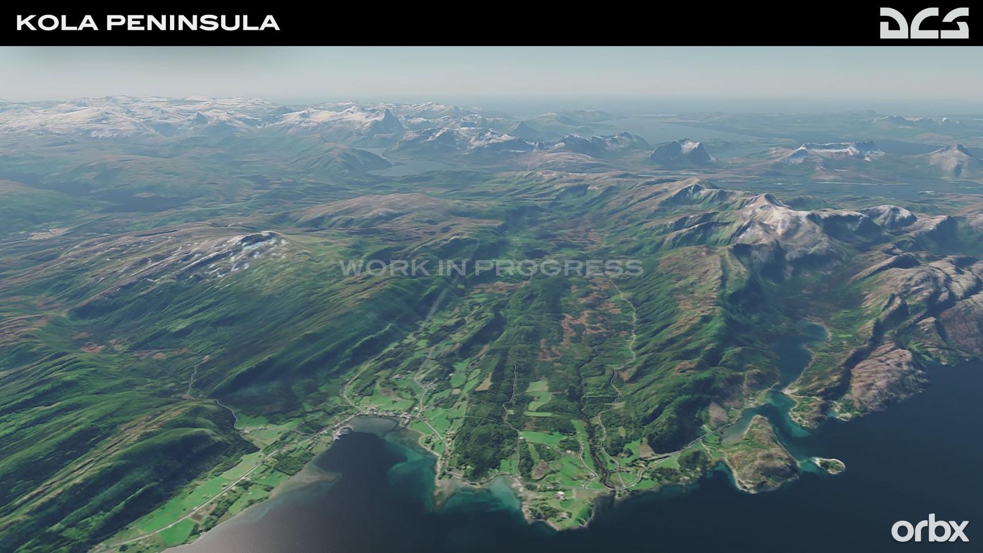
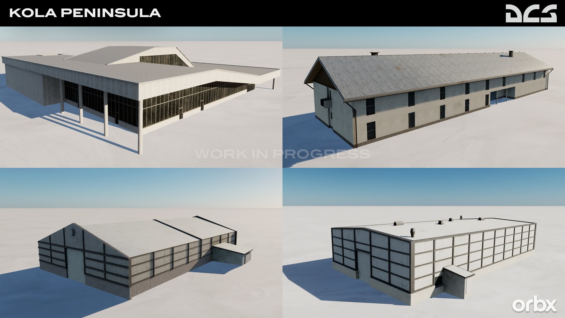
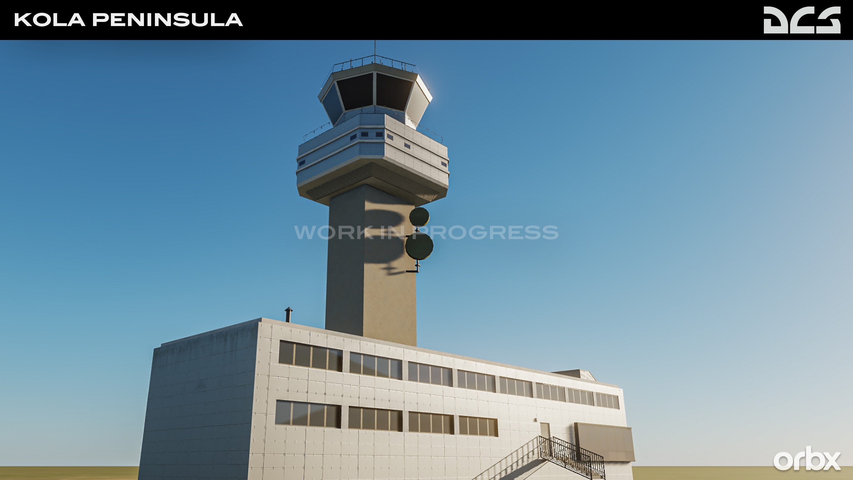
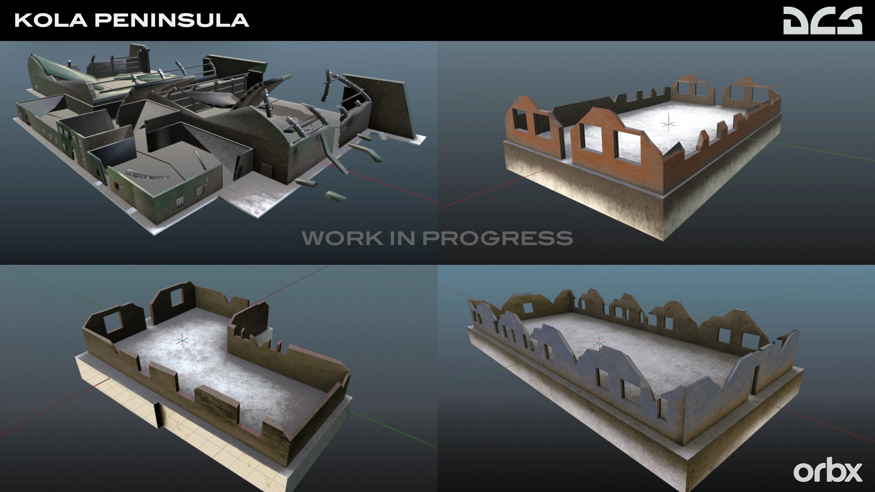
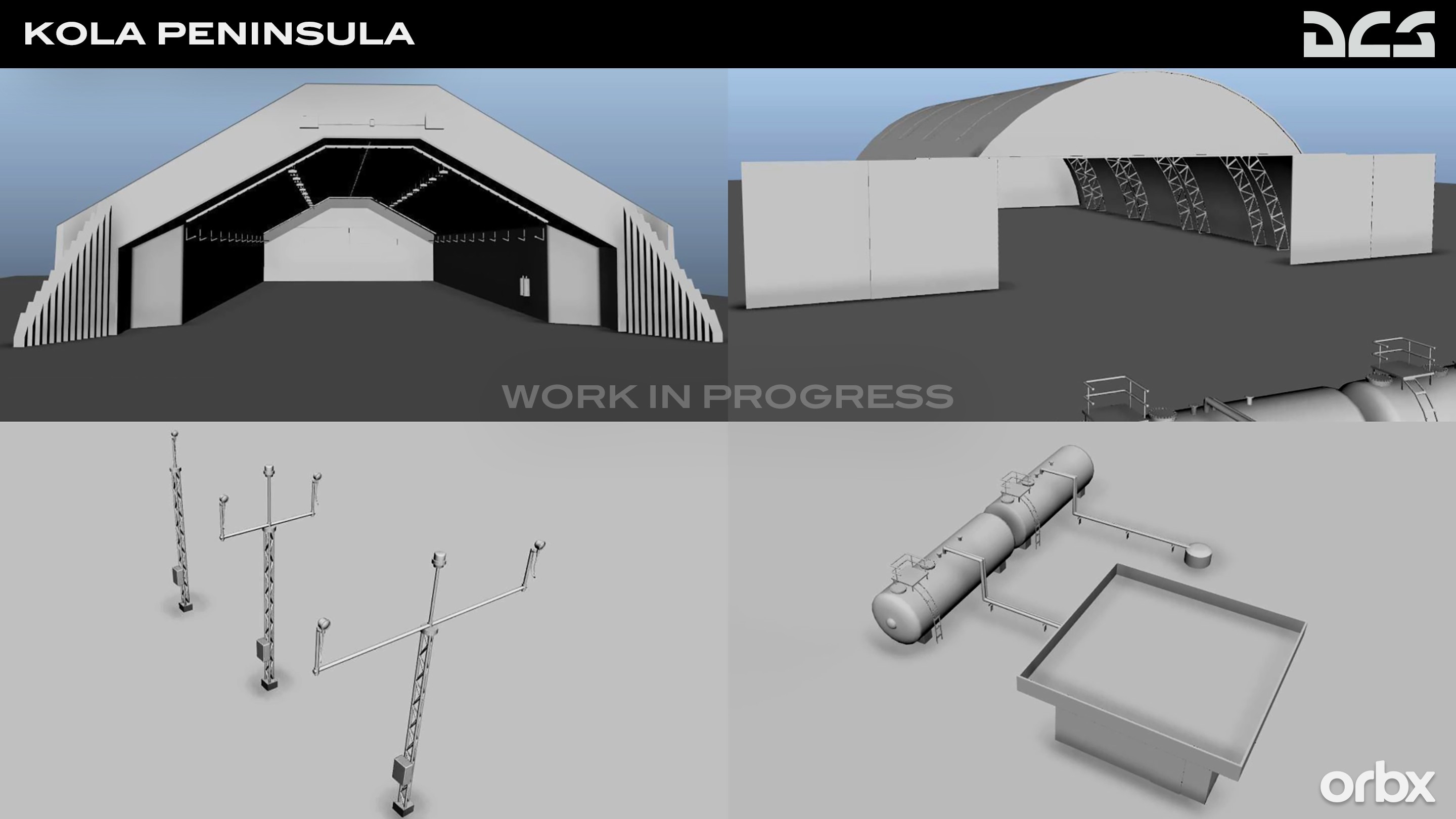
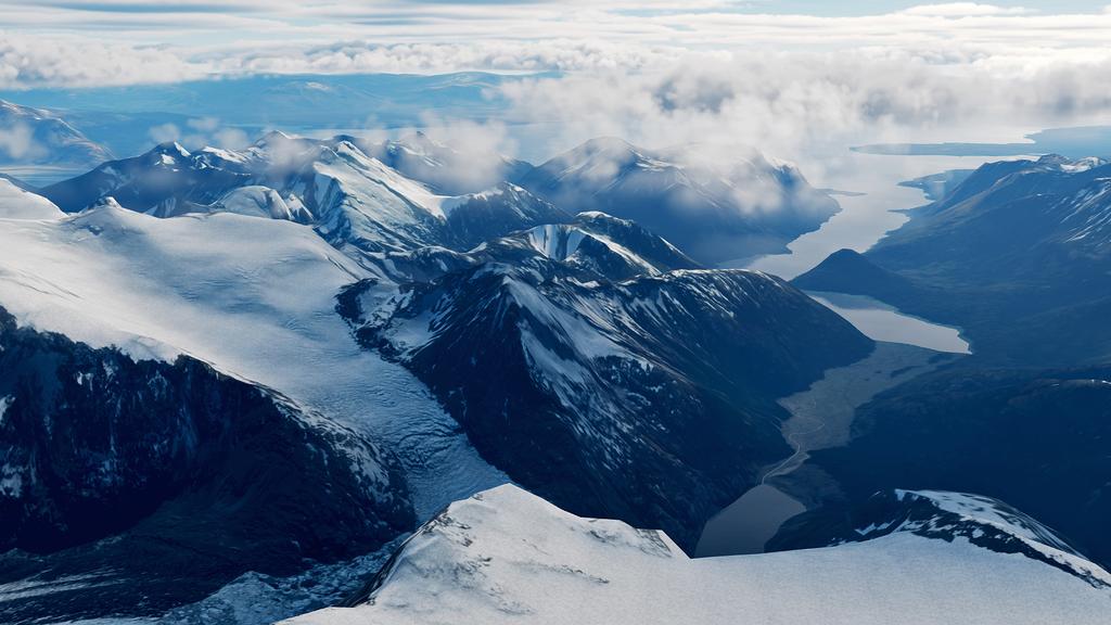
Kola Map Introduction
In collaboration with Orbx Simulation Systems, we are excited to announce the development of a new terrain module: the Kola Peninsula. Orbx has over 15 years of experience creating highly detailed scenery and airports for flight simulation platforms.
For Russia, the mostly ice-free ports of the Murmansk area, home of the Northern Fleet, are of immense strategic importance. Thus, the narrow land corridor from the Kola Peninsula to central Russia has evolved into dense clusters of military airfields and bases.
Similarly, the northern areas of Norway, Sweden, and Finland mirror the military and economic importance of this peninsula, with significant bases for all branches of the respective armed forces and extensive training ranges hosting key exercises for western alliances.
The Kola map will cover more than 550,000 square kilometers of land across northern Scandinavia and northwestern Russia, plus large sections of the Norwegian Sea and Barents Sea for naval operations.
Detailed airbases, included with the initial release of the Kola Map, will be Bodø, Bardufoss, Evenes, Rovaniemi, Luleå, Vidsel, Monchegorsk, Olenya, Severomorsk-1 and -3, and others. They will be modeled in their contemporary configuration. Beyond airfields, many of the important army and naval bases, test ranges, radar and storage sites will be added, as well as the entire road and railroad network.
Civilian POIs will also be represented, including key buildings, bridges, hydro dams, power plants, port facilities, and vertical obstructions.
Dramatic fjords and glaciers, with the many islands, creates an interesting coastline. The lake-studded taiga forests and arctic tundra complete the natural beauty of this region. Both Summer and Winter versions of the Kola map are planned.
The Orbx team is collaborating with experienced DCS campaign creators Baltic Dragon and Reflected Simulations to create engaging F/A-18C and F-16C campaigns at launch.

Bye
Phant
-
Phant
- Capitano
- Messaggi: 14316
- Iscritto il: 19 settembre 2003, 15:14
- Località: Olbia
-
Contatta:
Messaggio
da Phant » 12 agosto 2022, 18:20
Graphics - ED Team ha scritto:
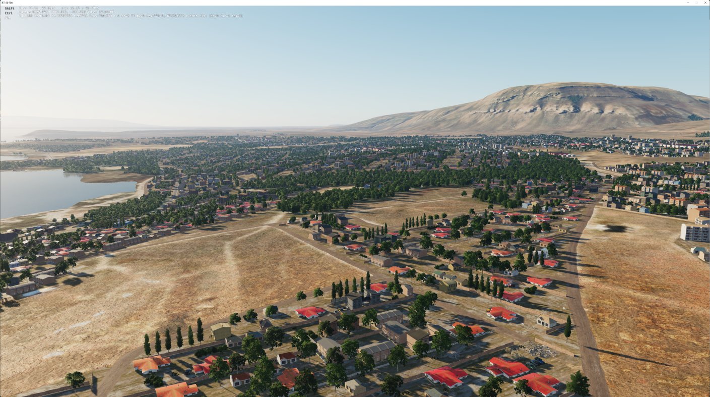
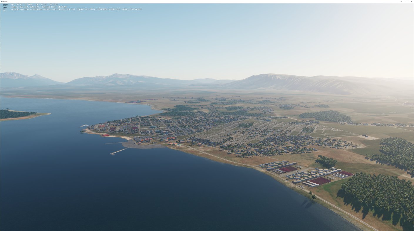
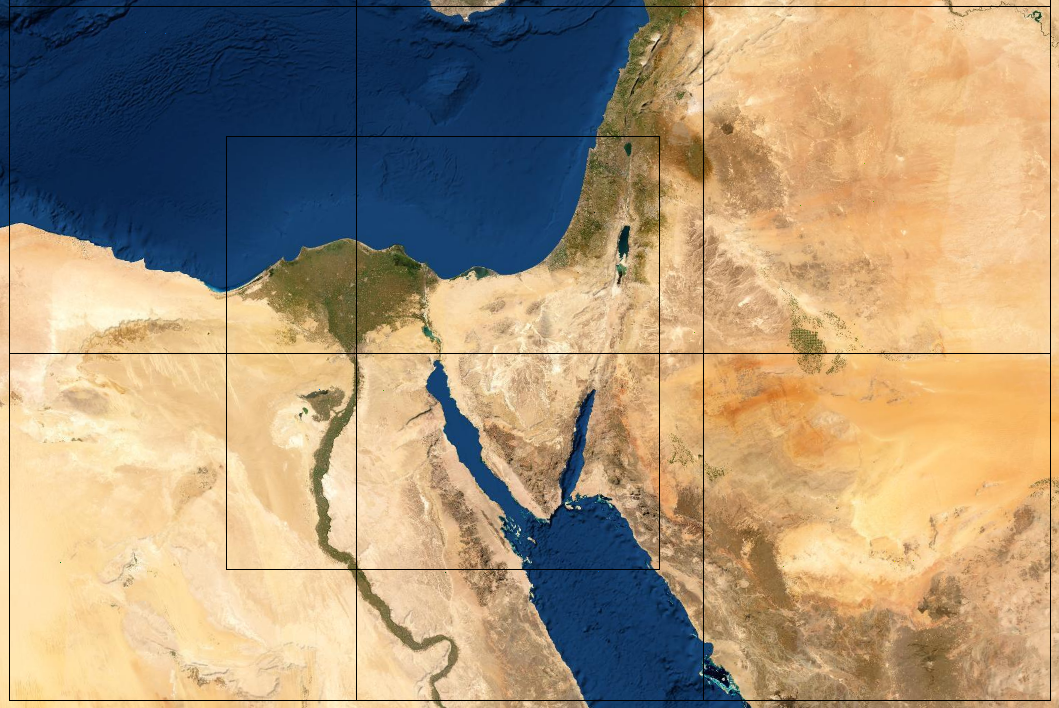
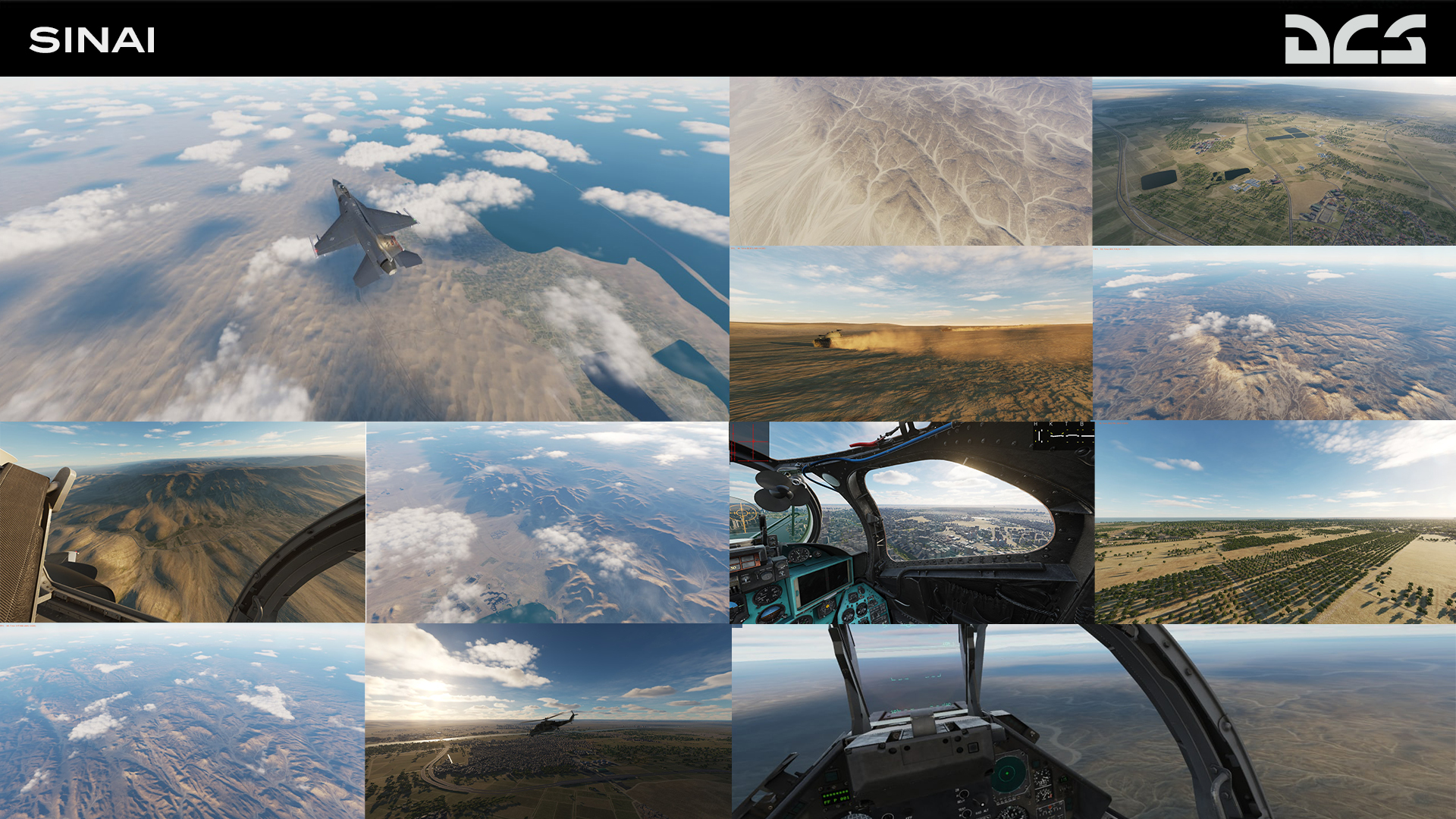
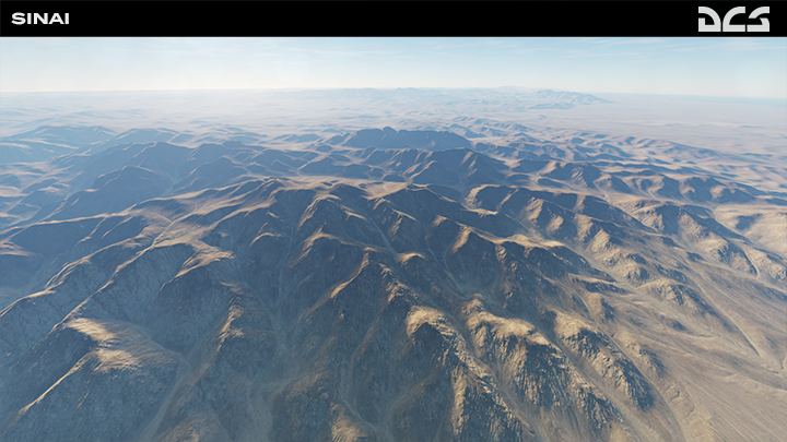
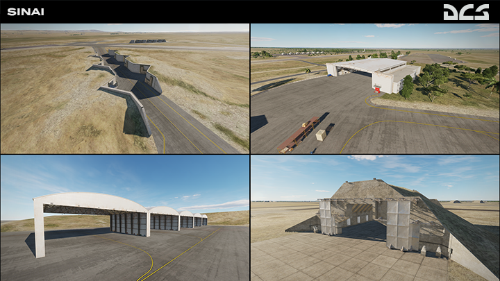
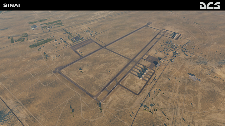
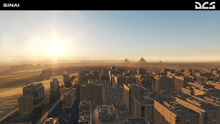
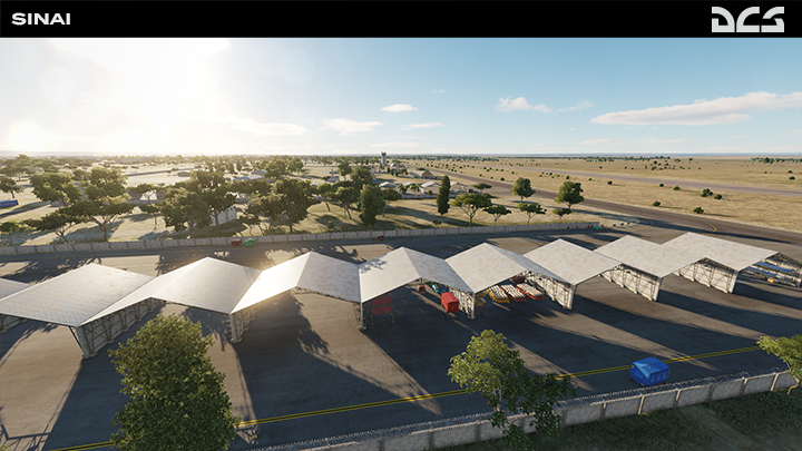
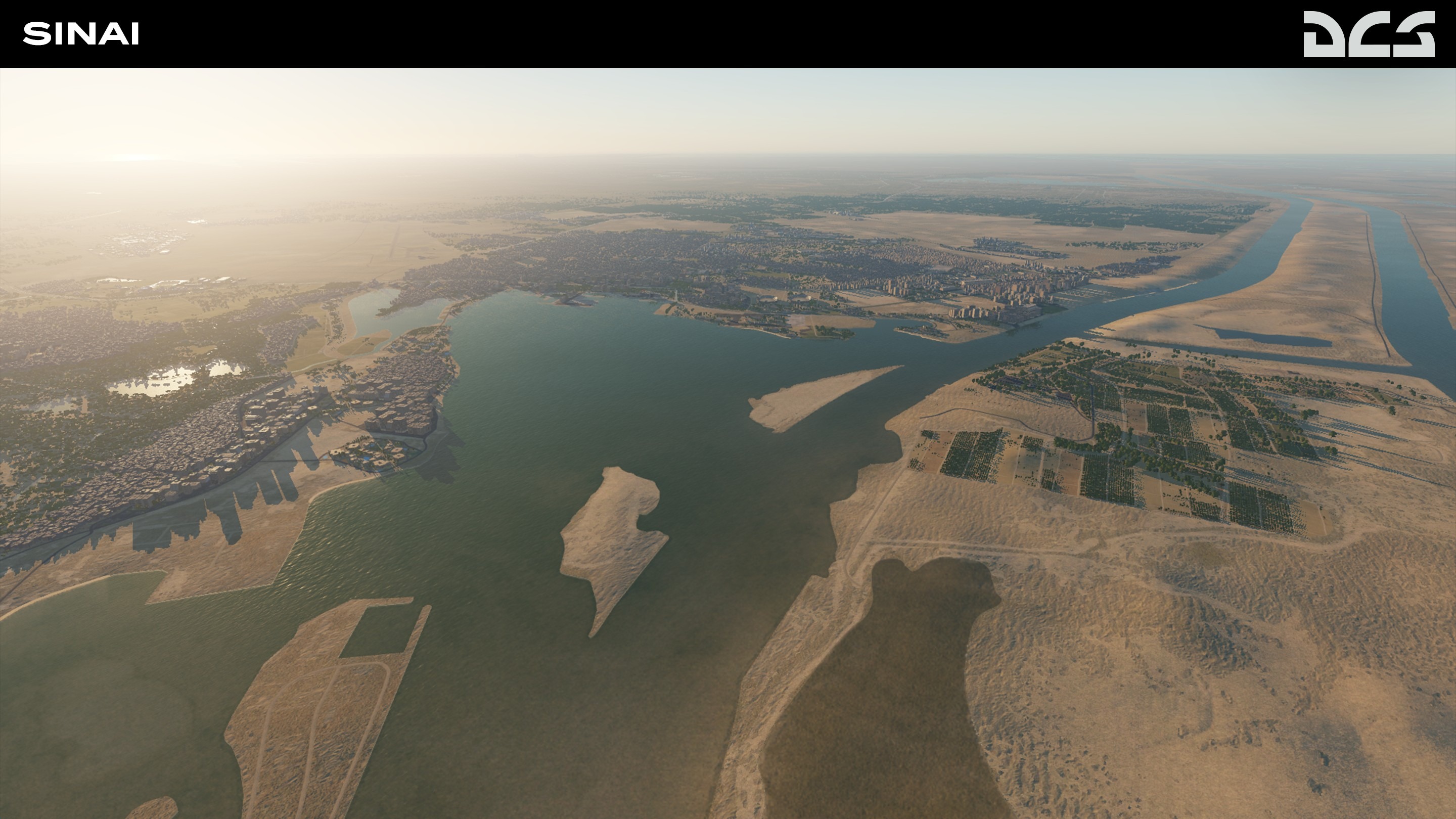
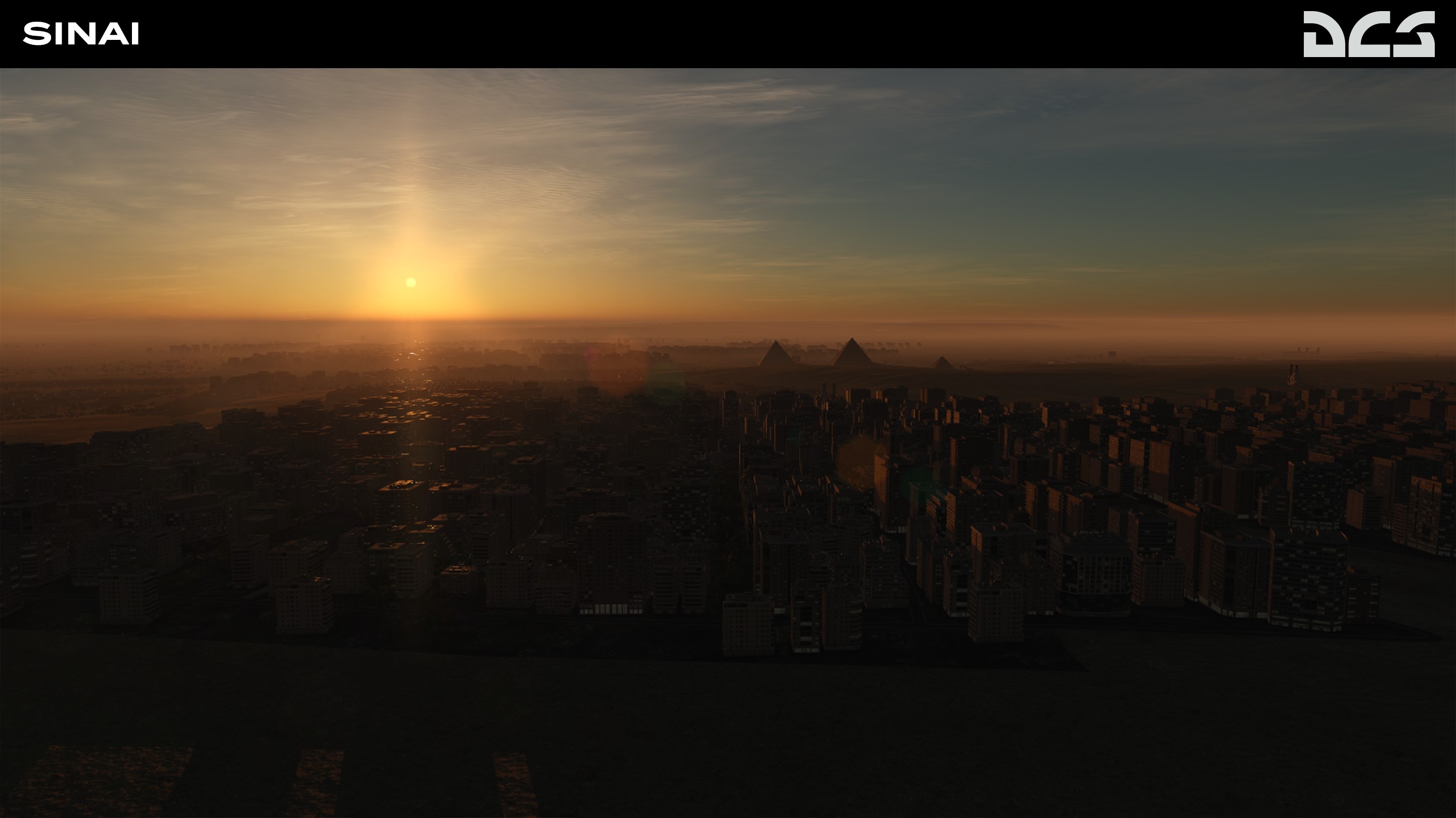
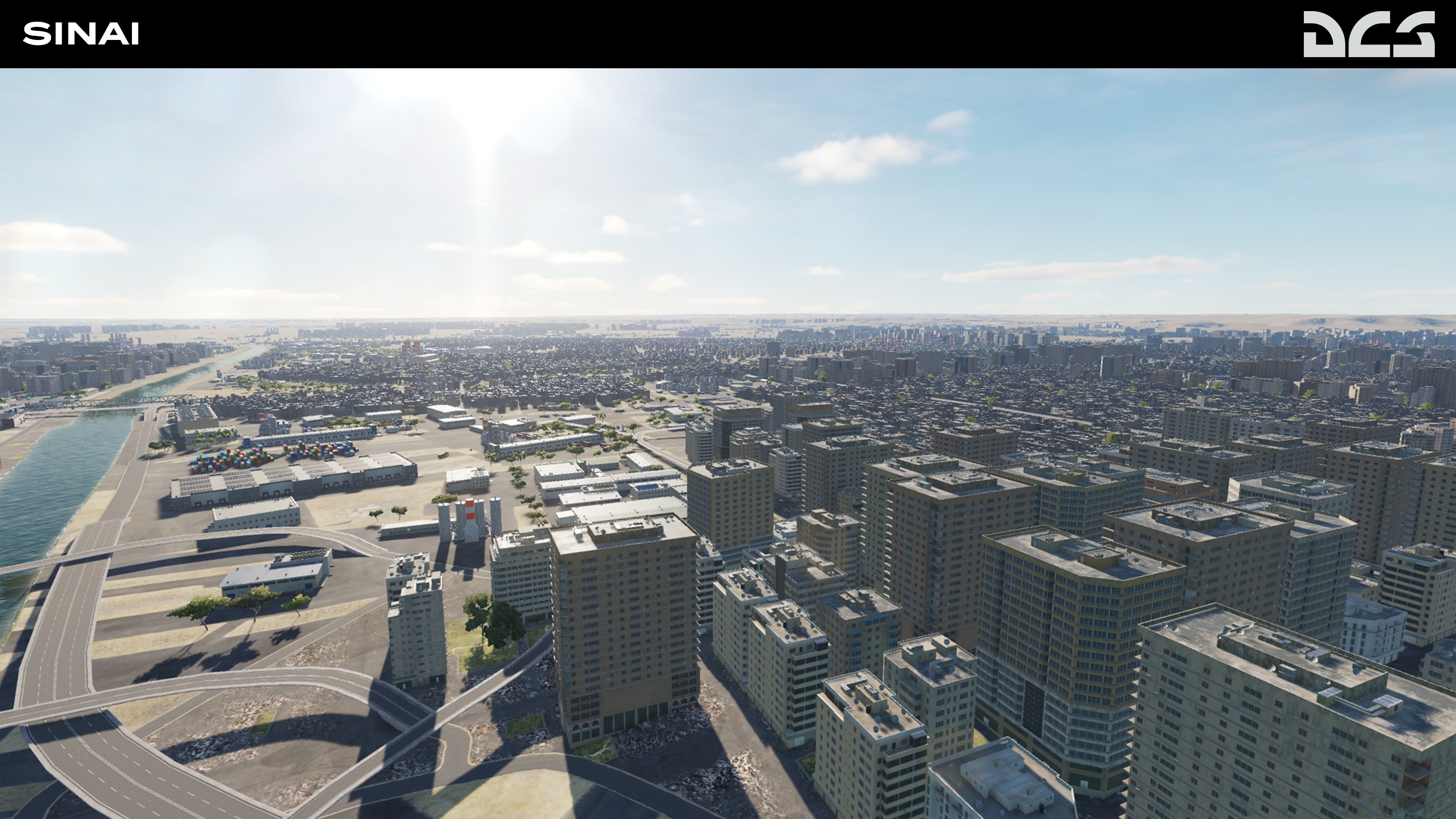
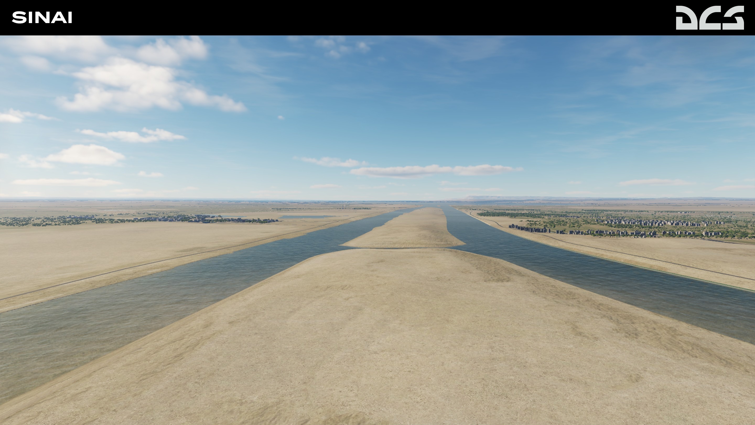
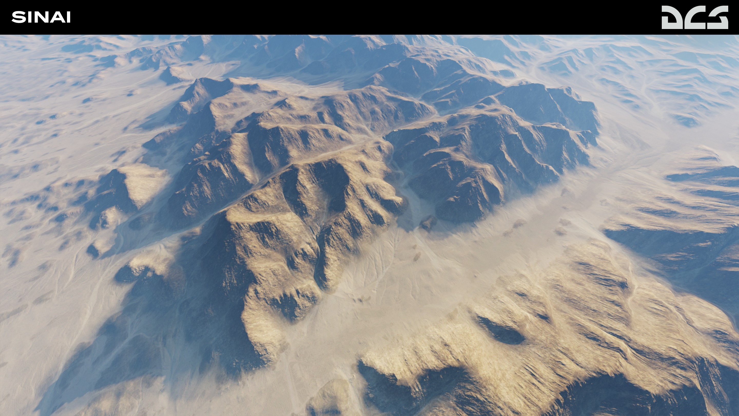
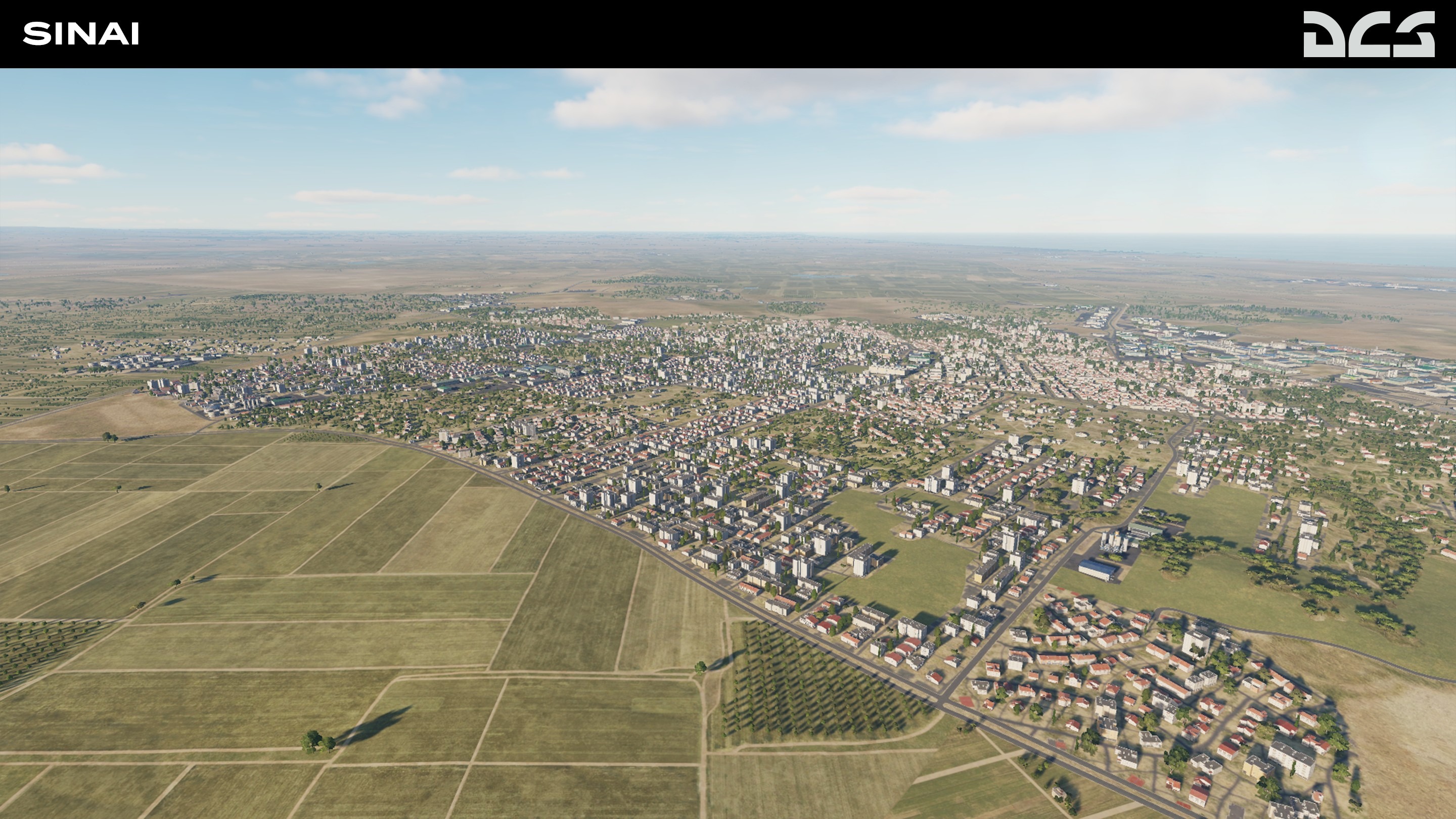
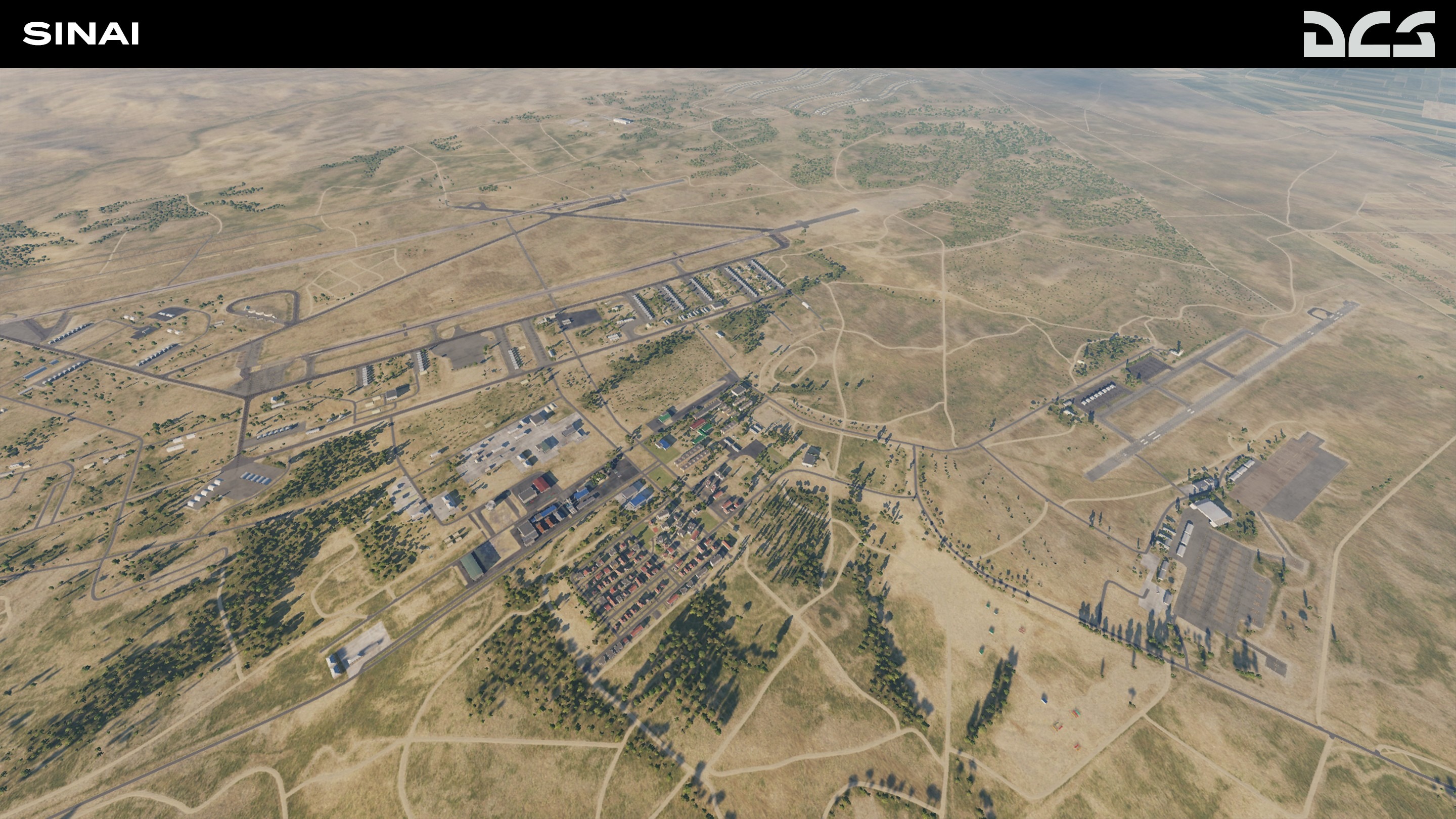
DCS: Sinai Development Report
We are pleased to introduce the upcoming DCS: Sinai map by third party developer OnReTech. This stunningly accurate representation of the Sinai peninsula, eastern Egypt and southern Israel will provide many opportunities for missions and campaigns based on fictional and historical scenarios.
The total size of the DCS: Sinai map is 1500 x 1000 km, of which, 700x700 km will be in high-detail. The map includes the entire Sinai Peninsula, eastern Egypt and the Nile Delta, southern Israel including Gaza, western Jordan, and western Saudi Arabia. This area features a wide variety of landscapes like mountains, rivers, desert, agricultural areas, sea and bays that provide a variety of mission and campaign settings.
The map is being designed to represent the 2000s and up to the present. It is planned to recreate about 40 airfields, both military and civilian: Wadi al Jandali, Abu Suwayr, Faid Air Base, Nevatim Air Base, Ramon Airbase, and many more.
The map also contains many military bases and strategic seaports that allow for interesting strike missions. A large number of military facilities and bases will help realize various historical scenarios based on the Arab-Israeli wars, as well as fictional missions and campaigns.
Major cities include Cairo (including Cairo International Airport), Ismailia, Alexandria, Suez, Port Said, and others. About 100 unique objects and architectural monuments will be included. All objects and assets are divided into territories to present greater unique, regional characteristics. The coastline of the Suez Canal, the Gulf of Suez, and the Gulf of Aqaba will be created in detail.
The project will consist of three phases, and each phase will include airfields, unique objects, and unique scenes. The first phase will include the entire territory with major cities and 14 air bases in Israel and Egypt. The second phase will add 11 more airfields. The third phase and final phase will add 12-14 more Egyptian military airfields. The OnReTech team is making every effort to ensure that customers will receive the first two phases in early access, which will help to fully reflect the theater of operations of the Arab-Israeli conflicts.
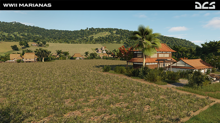
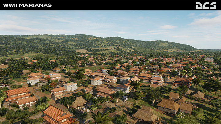
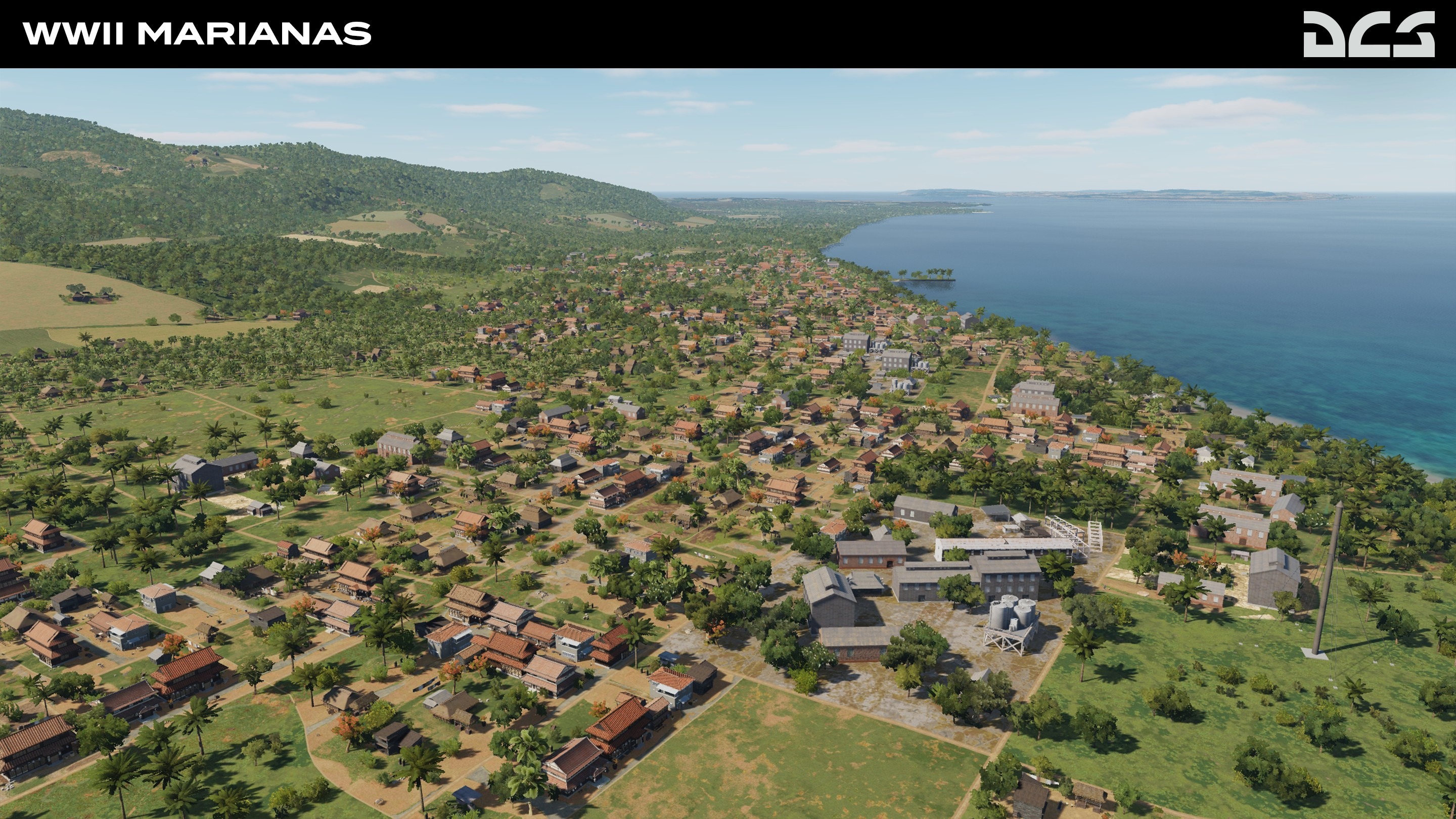
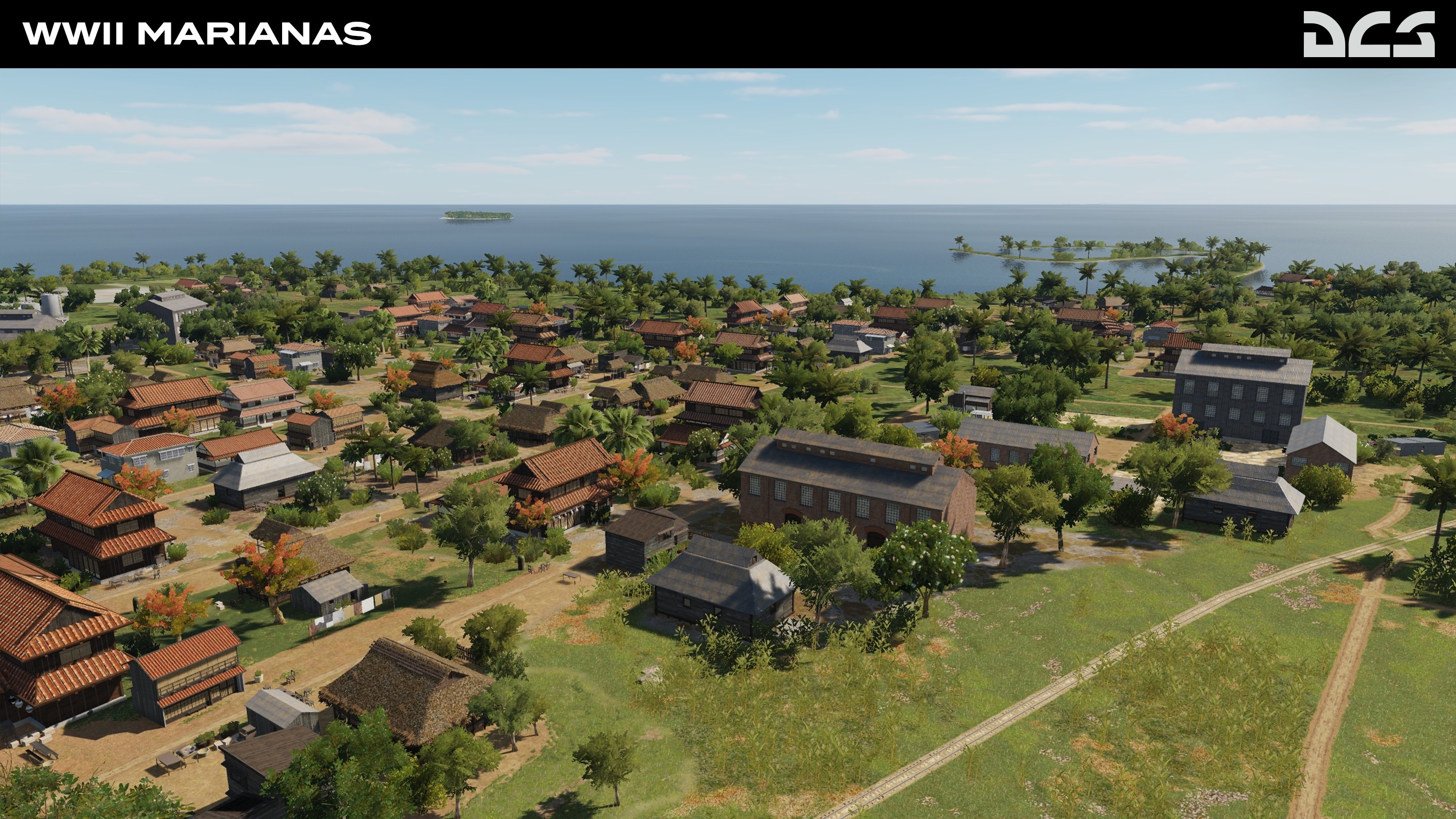
DCS: WWII Marianas Development Progress
In order to accurately depict the Mariana Islands in the summer of 1944, the coastline textures and fields are being completely redone based on actual pre-invasion maps courtesy of the United States Navy and Military. On the island of Saipan, all three Haruji Matsue plantations: As Lito, Chacha, and Marpi Point are being recreated. They provided tons of cane that was processed in the nearby sugar mills and taken to the Sugar Dock to be shipped to Japan.
The entire island of Tinian is also being recreated in high detail, and it comprises the original Japanese airfields. This large and mostly flat area is also where the first napalm bombs were used against Japanese soldiers hiding in the surrounding jungle and outlying small islands. We are also making improvements to the coastline, settlements, and palm plantations. For more, please check out the Development Screenshots.
Shortly before the retaking of Guam by US forces in June 1944, the island was still under control of the Japanese, it consisted of very small villages occupied by the native Chamorro people. In the modern Marianas map, a lot of this area is covered by cities, but in the Second World War, the land was made up mostly of palm plantations.

Bye
Phant
-
Phant
- Capitano
- Messaggi: 14316
- Iscritto il: 19 settembre 2003, 15:14
- Località: Olbia
-
Contatta:
Messaggio
da Phant » 15 agosto 2022, 1:53
-
Phant
- Capitano
- Messaggi: 14316
- Iscritto il: 19 settembre 2003, 15:14
- Località: Olbia
-
Contatta:
Messaggio
da Phant » 26 agosto 2022, 23:41
Graphics - ED Team ha scritto:
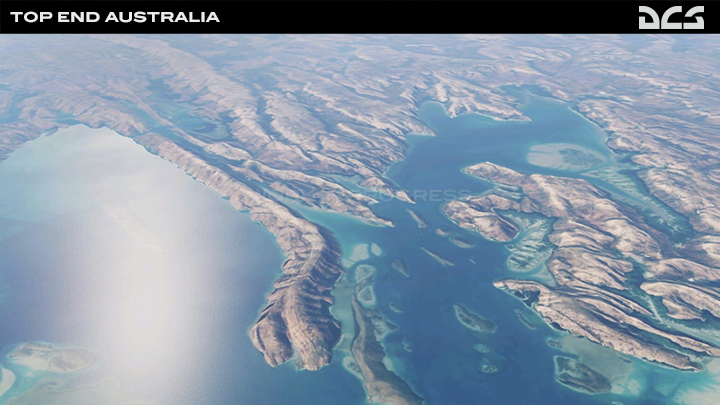
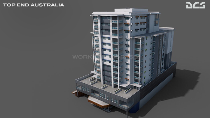
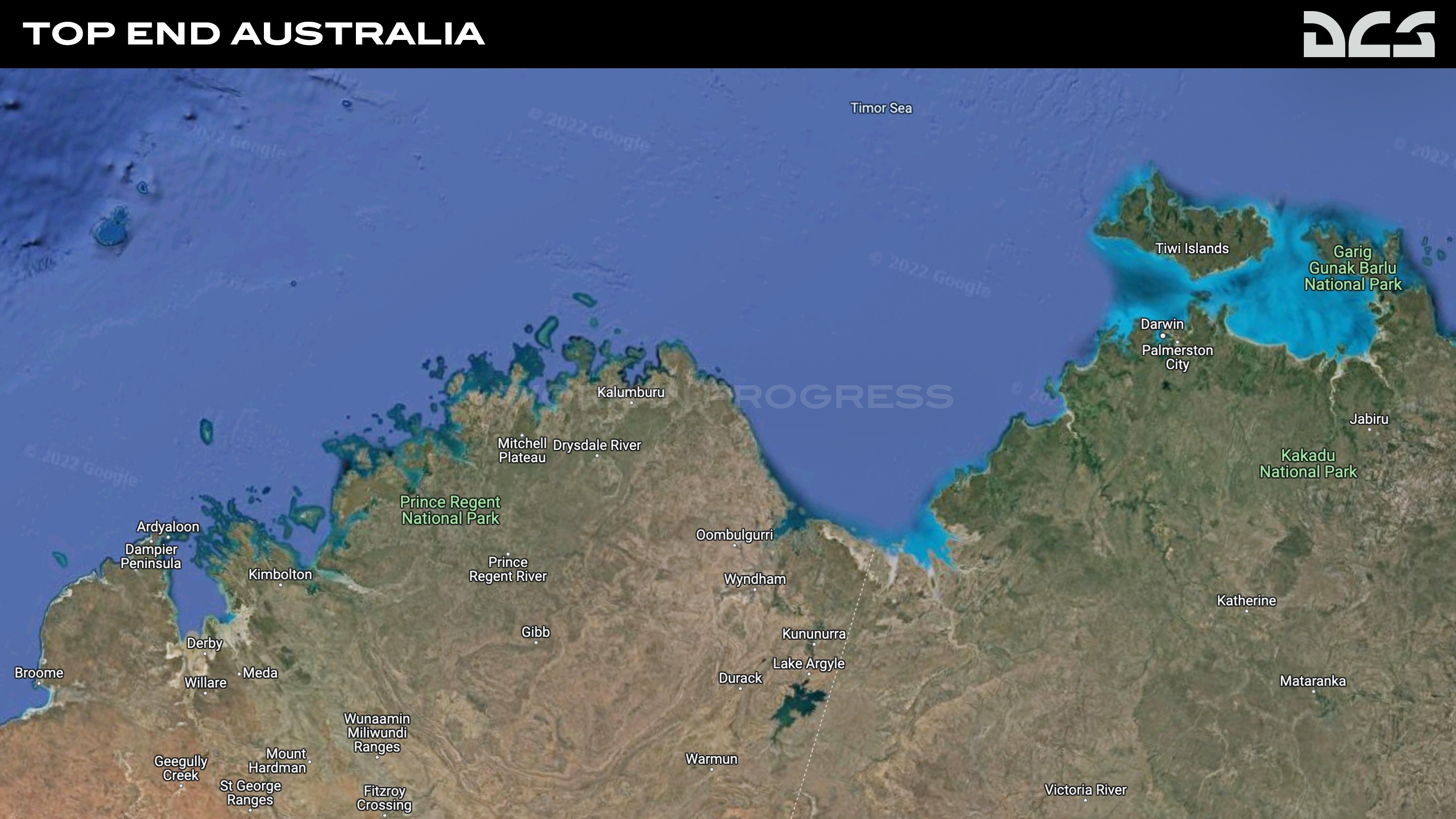
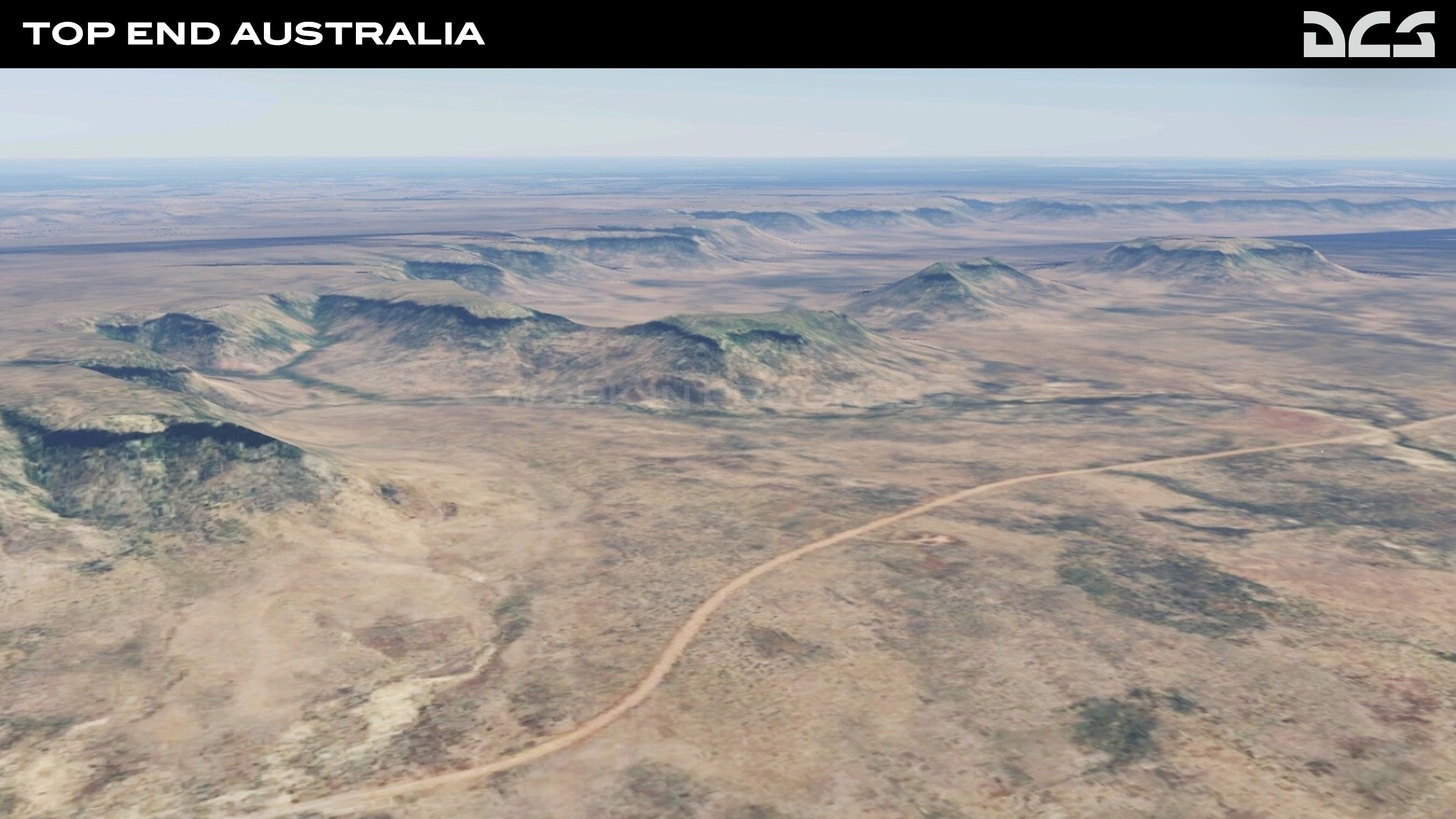
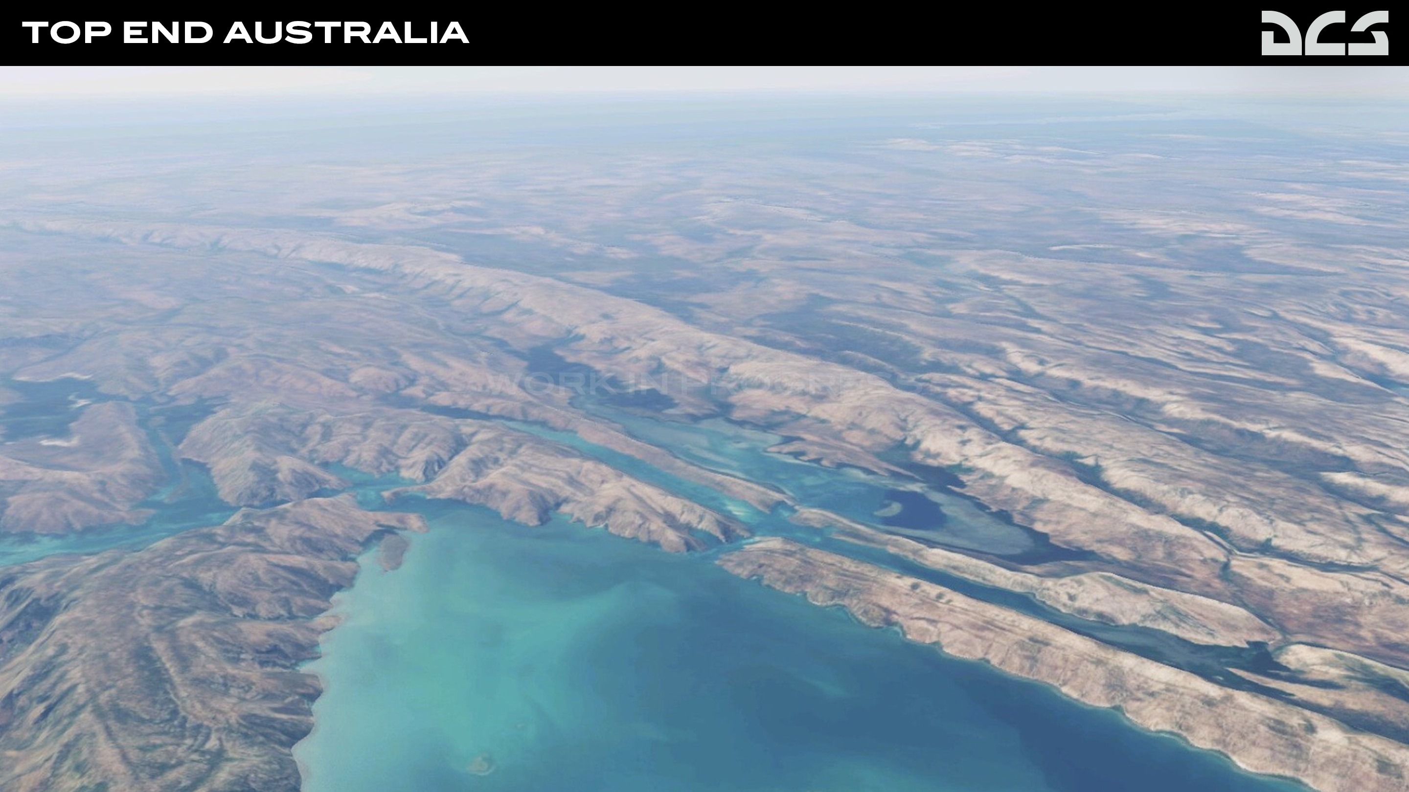
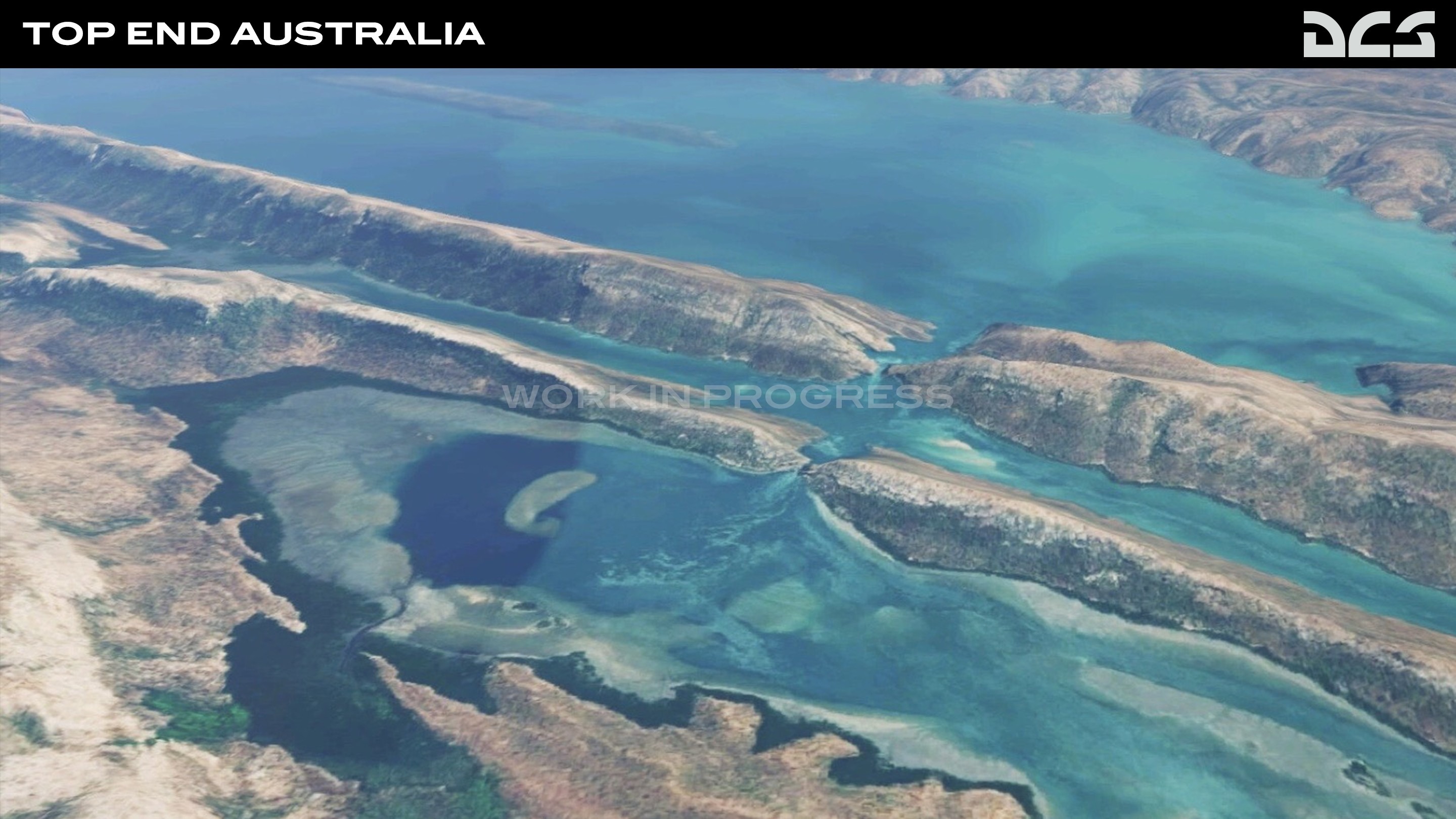
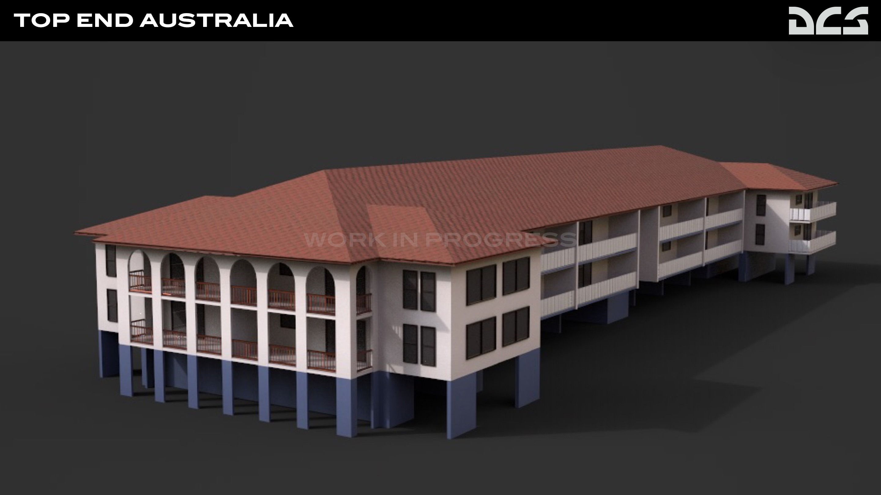
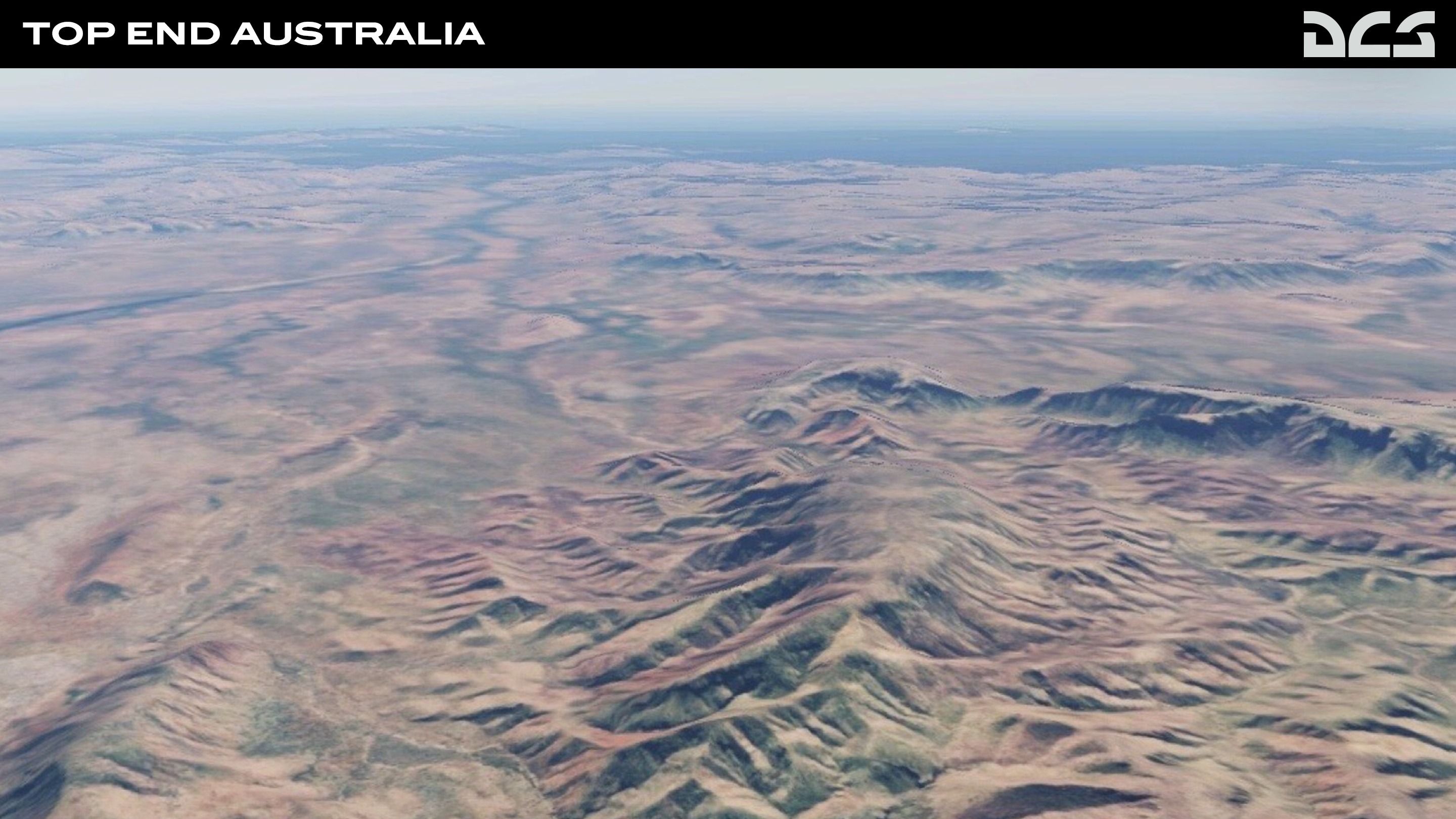
DCS: Top End Australia Introduction
We are excited to announce the DCS: Top End Australia map by third party developer, Check Six Simulations. This unique map will cover large swaths of northern and western Australia. It promises to be exceptionally beautiful and exotic.
The Top End Australia map covers 1,400 × 800km's of Australia's mainland including the Western and the Northern Territories. With a mixture of civilian and military airfields, aviators will experience a map that includes a rich red outback landscape complemented by the lakes and rivers, floodplains, coastline, and city centre of Darwin.
Infrastructure for major landmarks have been carefully detailed to provide the highest fidelity and includes Mindil Beach, Darwin, Broome, Tindal, Curtin, and the Delamere Weapons Range. The Top End Australia Map will give DCS players a unique experience to hone their skills across air, land, and sea domains allowing simulations of real-world exercises such as Pitch Black. Check out the Development Screenshots and stay tuned for future news as we look towards a report on their progress soon.
Bye
Phant
-
Phant
- Capitano
- Messaggi: 14316
- Iscritto il: 19 settembre 2003, 15:14
- Località: Olbia
-
Contatta:
Messaggio
da Phant » 7 settembre 2022, 6:42
-
Phant
- Capitano
- Messaggi: 14316
- Iscritto il: 19 settembre 2003, 15:14
- Località: Olbia
-
Contatta:
Messaggio
da Phant » 20 settembre 2022, 1:17
-
Phant
- Capitano
- Messaggi: 14316
- Iscritto il: 19 settembre 2003, 15:14
- Località: Olbia
-
Contatta:
Messaggio
da Phant » 28 settembre 2022, 1:07
-
Phant
- Capitano
- Messaggi: 14316
- Iscritto il: 19 settembre 2003, 15:14
- Località: Olbia
-
Contatta:
Messaggio
da Phant » 28 settembre 2022, 1:30
OnReTech - 3rd Party Developers ha scritto:
DCS: Sinai Map FAQ and Updates
Who is developing this map?
OnReTech was formed in October 2021 to develop terrains. With more than seven years of experience creating terrains for flight simulators, including DCS, we have assembled a team of dedicated artists, engineers, researchers, and managers to create new and interesting battlefields for DCS World.
Why Sinai?
The Sinai map is of great historical importance that includes several past conflicts. The map will include different types of surfaces, large and small rivers, forests, fields, and mountains. Large and small cities, many military airfields, road and rail networks, ports will also be included. Despite large portions of desert, the map will also include greenery and forests along the Nile Delta and in Israel.
What does the Sinai roadmap include?
The project is divided into three phases in total:
- Early access: first + second phase.
- Map update: bonus phase with expansion of the detailed territory with 3-4 additional airfields (it's a secret for now; we're still considering which ones).
- Final release: third phase
First phase
This will Include a 1500 x 1000 km area. Of this, a 700 by 700 km will be created in high detail and accuracy. Phase 1 will include many large and small cities like Cairo and include landmarks like the pyramids of Giza. Both natural and manmade features will be included.
- Airfields of the first phase:
- Egypt:
- Al Ismailiyah Air Base
- Faid
- Kibrit Air Base
- Abu Sultan
- Abu Suwayr
- As Salihiyah
- Bir Jifjafa/Malez
- Wadi al Jandali
- Israel:
- Nevatim Airbase
- Hatzerim Airbase
- Ramon Airbase
- Uvda/Ovda
Second phase
Additional unique objects and scenery for Israel and Egypt will be added.
- Airfields of the second phase:
- Egypt:
- Al Mansurah
- Az Zaqaziq
- Inshas Airbase
- Cairo International Airport
- Cairo West (Almaza)
- Bilbeis Air Base
- Israel:
- Sde Dov Airport
- Palmachim Airbase
- Hatzor
- Tel Nof
- Ben Gurion
Third phase
- Airfields of the third phase:
- Egypt:
- Quwaysina
- Birma/Tanta Air Base
- Al Rahmaniyah
- Borg-el-Arab/Intl
- Jiyanklis New
- Gebel el Basur
- Al Khatatbah
- Kom Awshim
- Beni Suef
- Wadi Abu Rish
- El Minya
- Hurghada
- Wadi Abu Shihat
When will this map be available?
We are planning an early access release in the first quarter of 2023. This is subject to change.
How much will this map cost?
- Base price - $49.99 USD
- Early access - $39.99 USD
What period is this map based on?
The map is being designed to represent the 2000s to the present.
Bye
Phant
/Reparto_Affari_Generali.png)


 ) We are continuing to add the grass low level detail to the mainland which does make a massive difference when at low level. I also just wanted to say for those that bought the map a big thank you from the Terrain Development Team, your faith and support is really appreciated.